
Washington Hikes – Mount Pilchuck Lookout Hike
Here at Explore Washington State, we’re always interested in finding out about people who are actively exploring new areas of Washington, whether that’s checking out new hotspots in urban areas, or out scrambling around in the woods with a GoPro.
Just a few weeks ago, we ran across the YouTube channel Outside & Stuff, which features two adventurous Washingtonians routinely doing the latter. Starting with an overview of the popular Mount Pilchuck Hike (a little more than an hour northeast of Seattle), we want to start highlighting some of their excellent work — making hikes around the state more accessible and fun through their informative and down-to-earth hiking videos.
Video: Hiking Washington – Mount Pilchuck
(Used with permission, see note at end of article for more info)
This video isn’t fancy or over-produced, but it’s well done and informative… just what we like to see! Real people exploring the state and sharing it with others.
Overview: Mount Pilchuck Lookout Hike
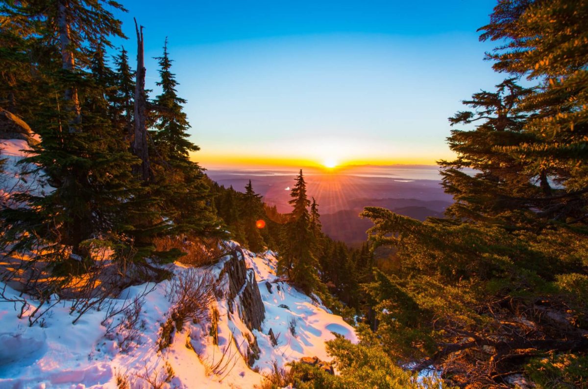
Incredible panoramic views make this in the top five most popular hikes in the state. Moral of the story: Get there early if at all possible. Intermediate to strenuous hike, and definitely tougher if it’s rained or snowed recently. Pretty good description of the hike here, but make sure to watch the video above to get some visual reference points as well.
Mount Pilchuck Lookout Hike Fast Facts
- Mount Pilchuck State Park
- Distance: 5.4 miles (roundtrip)
- Location: North Cascades (45 minutes east of Everett, WA)
- Elevation: 5327 ft at the top, a gain of about 2300 ft during the hike.
- Pass Required: Yes. The Northwest Forest Pass ($30). More details here.
- Cool Features: A restored fire lookout at the summit. Awesome views when it’s not cloudy (I know, I know… that seems obvious, but a lot of people leave disappointed because there tend to be quite a few days when the clouds are really socked in and you can’t see much at the top. But hey, there’s still the fire lookout…) You can also check current weather conditions here.
- GPS Track: http://bit.ly/29GKeDN
Mount Pilchuck Lookout Hike: Map and directions:
Hint: To get a great idea of the terrain surround the Mount Pilchuck hike, open up this map in your browser and switch into 3D mode.
Directions to Mount Pilchuck Lookout Trailhead
Take Highway 92 from Everett toward Granite Falls. You’ll come to a roundabout. Take the second exit for Quarry Road. Stay on that road for 2 miles. At the next roundabout, stay on Quarry Road. After 2 miles, you’ll get to the Mountain Loop Highway. Take a left onto that highway and after about 10 miles, you’ll pass the Verlot Visitors Center. Go past the visitor’s center, cross a bridge, then take the next right onto the Mount Pilchuck Road.
After making that turn, look for a sign that reads FR 42. Go 6.8 miles down this road and you’ll reach the parking lot. The last mile of the road will switch from paved to unpaved.
GPS and cell phone may lose reception toward the end of your drive, so it’s a good idea to have a topo map or a printout of directions so you’re prepared in case Google Maps goes down.
Publishers Note: We contacted Nick from the videos and he gave us permission to share his videos and info. You can check out their other super helpful hiking videos here. They don’t sponsor us, and we’re not pushing them for any reason other than we think they do a really nice job of presenting simple but beautiful overviews of hikes in Washington. If you’ve ever tried filming in the woods or searching for realistic, helpful and down-to-earth hiking videos online, you’ve seen what a challenge this is to pull off.
Share your stories about hiking the Mount Pilchuck Lookout Trail. Leave your comments below.
- About the Author
- Latest Posts
Explore Washington State has been covering the real Washington for more than a decade. State parks, small towns, back roads, rest stops, and the people who make this place worth exploring. What started as a hyperlocal project covering individual communities grew into a full media project with more than 340 podcast episodes, a weekly newsletter with over 4,800 subscribers, and coverage of all 146 Washington State Parks. The content here comes from people who have actually been to these places: locals, regulars, and lifelong Washington residents who care more about getting it right than getting clicks.


