A Curious Washingtonian’s Guide to Birding the North Cascades Highway (SR 20)
Saturday Verdict: Worth a full day. Worth two days if you time it for late April or early May.
Birding North Cascades Highway (SR 20) is something most of the spring crowd misses entirely. The road opens every season to motorcyclists, photographers, and people who have been watching the WSDOT pass cam since March. What most of them do not know is that the highway opens at roughly the same time the Harlequin Ducks show up.
That is not a coincidence you plan for. But if you happen to be driving SR 20 in the first two weeks after opening day, and you stop at any fast-moving stream between Newhalem and Mazama, you might see a pair of Harlequin Ducks riding the current in ways that seem designed to challenge your understanding of what a duck is supposed to do.
217 bird species have been recorded in North Cascades National Park (National Park Service). SR 20 cuts through the middle of it. You do not need binoculars to see some of them. You do not need a life list. You need to slow down at the right spots.
Here is where those spots are.
The Highway Window
SR 20 closes at the high passes every winter. The segment between Ross Dam Trailhead (milepost 134) and Silver Star Gate (milepost 171) typically shuts down in early December and reopens somewhere between early April and late May, depending on snowpack. Recent years have fallen in mid-to-late April. Heavy-snow years push into May.
The best birding window on the highway is mid-May through mid-August. In June and July you get the full drive without snow and with summer residents at peak activity. August is still productive but migration starts thinning by the end of the month.
If you are coming specifically for Bald Eagles, the window is different. The Skagit River near Rockport hosts one of the largest wintering Bald Eagle concentrations in the continental United States. That window is December through February. The highway is accessible that far west even when the passes are closed.
One Thing Nobody Tells You: The Harlequin Duck Window
Harlequin Ducks spend the winter on Puget Sound and along the outer coast. In April, they migrate inland to breed. North Cascades National Park is one of their primary destinations.
The timing overlaps with the highway opening in many years. Harlequins arrive throughout April. The highway typically opens late April to mid-May. In years with an early opening, the first week or two of driving SR 20 is also prime Harlequin time. In heavy snow years, they may already be inland before the pass opens.
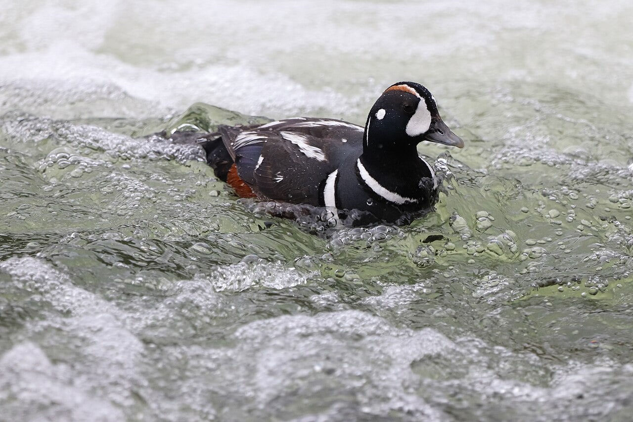
If you plan a trip for the first week or two after opening day, and stop at any fast-moving creek, particularly along the Skagit River or at Gorge Creek near milepost 123, you have a real shot at seeing them. They are built for white water. A Harlequin Duck in a rapid looks like it belongs there in a way most waterfowl do not.
By early June, they have dispersed into the higher-elevation streams and the easy roadside viewing is gone.
West to East: Birding North Cascades Highway Stop by Stop
The full drive from Burlington to Winthrop is roughly 150 miles and about 3.5 hours without stops. Plan for six to eight hours if you are birding it properly.
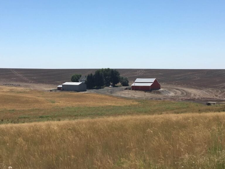
Rockport and the Skagit River Valley
Before you reach the national park, you pass through the Skagit Valley. In spring and summer: Osprey and Great Blue Heron along the river, Common Merganser in the shallows, Tree Swallow and Violet-green Swallow over the fields. Standard low-valley stuff, but worth a slow scan.
In winter, the situation changes. The lower Skagit near Rockport and Concrete is one of the largest Bald Eagle concentrations in the lower 48 states. The birds gather to feed on spawned-out salmon. At peak winter, it is not unusual to see 50 or more eagles in a single morning. Most people who drive SR 20 in summer have no idea this is eagle territory. It is. Just not in July.
Rockport State Park at milepost 96 is worth a stop on the west end (Discover Pass required for day use). Old-growth Douglas Fir means Pileated Woodpecker, Brown Creeper, Chestnut-backed Chickadee, and Varied Thrush in the understory. The Varied Thrush has a single-pitch sustained whistle that sounds like it belongs in a different landscape entirely. You will hear it before you see it.
Newhalem and the Gorge (Mileposts 119-130)
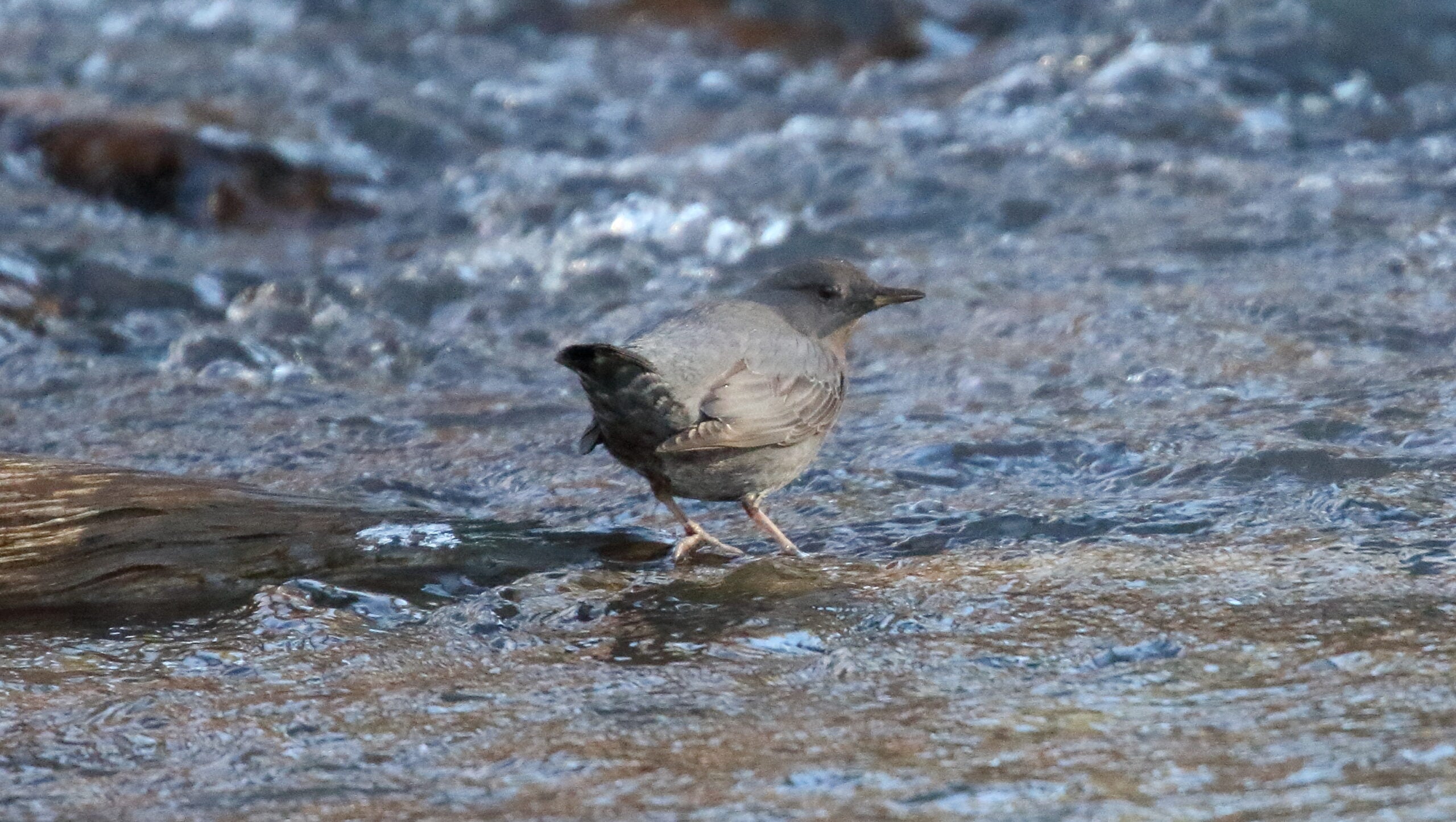
Newhalem is the first gateway town inside the national park complex. The North Cascades Visitor Center is here. Stop. Not for the pamphlets. Stop because the Skagit River runs fast and cold right next to town, and that means American Dipper habitat.
The American Dipper is the only truly aquatic songbird in North America. It is a small, gray, unremarkable-looking bird that dives into fast-moving streams and walks along the bottom. It bobs at the waterline, bobs some more, and then plunges in. If you stand on any bridge over fast water in the North Cascades and watch for ten minutes, there is a reasonable chance one shows up.
Gorge Creek, just east of Newhalem near the Gorge Creek Falls pullout around milepost 123, is a reliable spot. The falls are a five-minute walk from the road. The dipper habitat is the creek at the base.
The Pacific Wren is also here, in the tangles of the understory. Small, brown, incredibly loud for its size. It will sing at you continuously without showing itself. Both Pacific Wren and Varied Thrush are audible from the parking area without leaving your car.
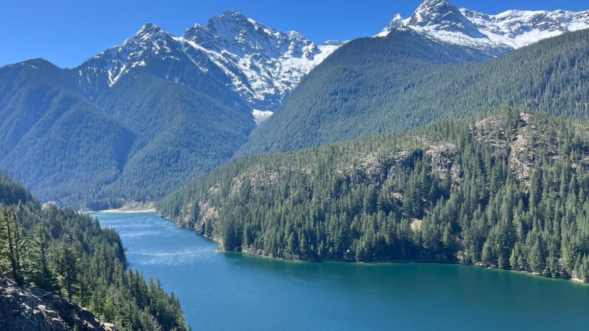
Diablo Lake and Colonial Creek (Mileposts 126-131)
The Diablo Lake Overlook at milepost 131 is one of the most photographed spots on the highway. The turquoise water comes from glacial flour, fine sediment that scatters light differently than a normal lake. Worth the stop regardless of birds.
For birds: Osprey fish here most of the summer, dropping from height in ways that are hard to ignore. Belted Kingfisher along the shoreline. Common Merganser in the shallows. Great Blue Heron on any visible rock or snag near the water.
Colonial Creek Campground, on the south side of the highway at milepost 130, has a day-use area with access to the creek. This is another reliable dipper location. It is also a Harlequin Duck spot in early May.
The Thunder Woods Nature Trail at Colonial Creek is 0.3 miles, mostly flat, and runs through mature forest. Red-breasted Nuthatch, Golden-crowned Kinglet, and Chestnut-backed Chickadee are reliable here. Pileated Woodpecker moves through periodically.
Ross Lake Viewpoint (Milepost 135)
A small pullout with northerly views up Ross Lake. The lake is 23 miles long and stretches to the Canadian border.
This is a Common Loon location in spring and early summer. They do not congregate here in numbers, but if you are patient in the early morning, you may hear the call before you see the bird. Common Raven is reliable from this pullout. Bald Eagle is possible over the lake.
This stop does not require more than fifteen minutes. Take the view, scan the water, continue east.
Rainy Pass (Milepost 160, Elevation 4,862 feet)
By the time you reach Rainy Pass, you are in a different bird community. The species here are subalpine specialists and several of them are genuinely difficult to find anywhere else in the state.
The Three-toed Woodpecker is the best bird at Rainy Pass. It is a permanent resident throughout the area and the most consistently reported woodpecker at this elevation. It works dead and dying conifers methodically, often staying in one area for extended periods. Findable with patience. Bring binoculars.
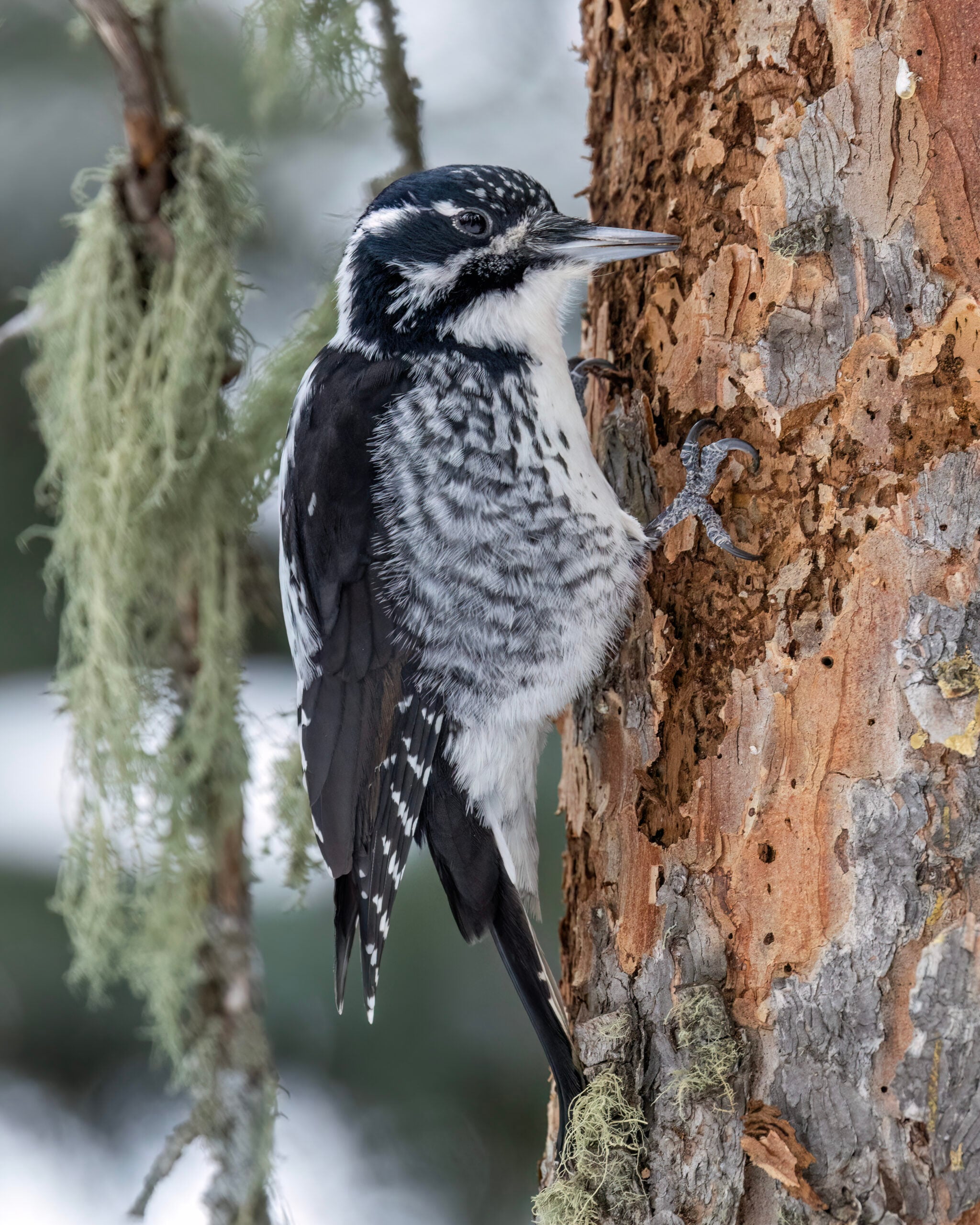
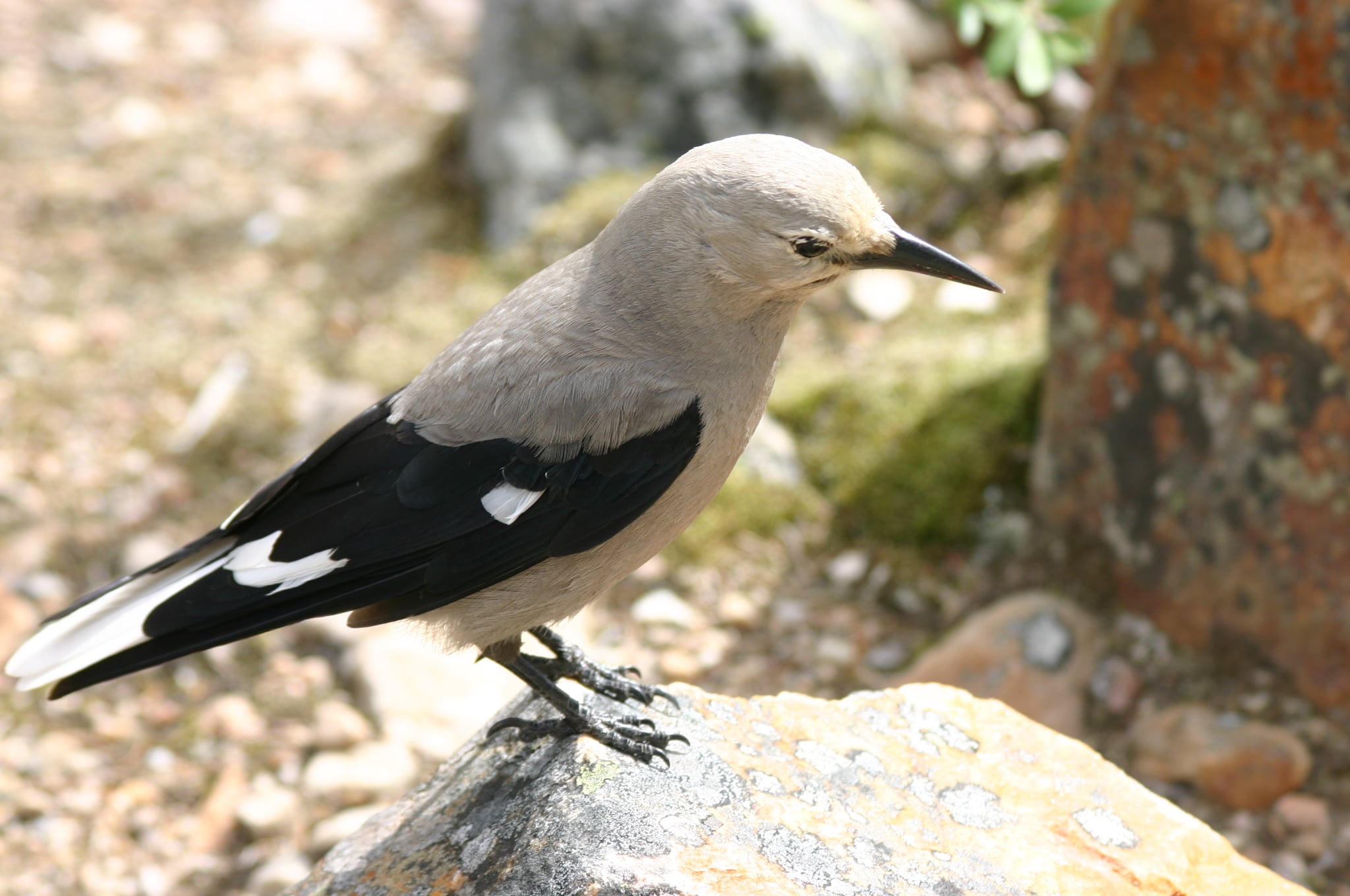
Clark’s Nutcracker is loud and unmissable. It sounds like someone complaining about something. Canada Jay (formerly Gray Jay) will approach you if you have food out. Do not feed the Canada Jays. They will remember and expect it.
Mountain Chickadee replaces Chestnut-backed at this elevation. Townsend’s Warbler in the conifers. Hermit Thrush calling from the understory in early summer. Dark-eyed Junco everywhere.
The Rainy Lake Trail leaves from this pass: 1.8 miles one-way, relatively flat, ending at a subalpine lake with a waterfall. Birds are consistent all the way along. Best timing: mid-July to mid-August.
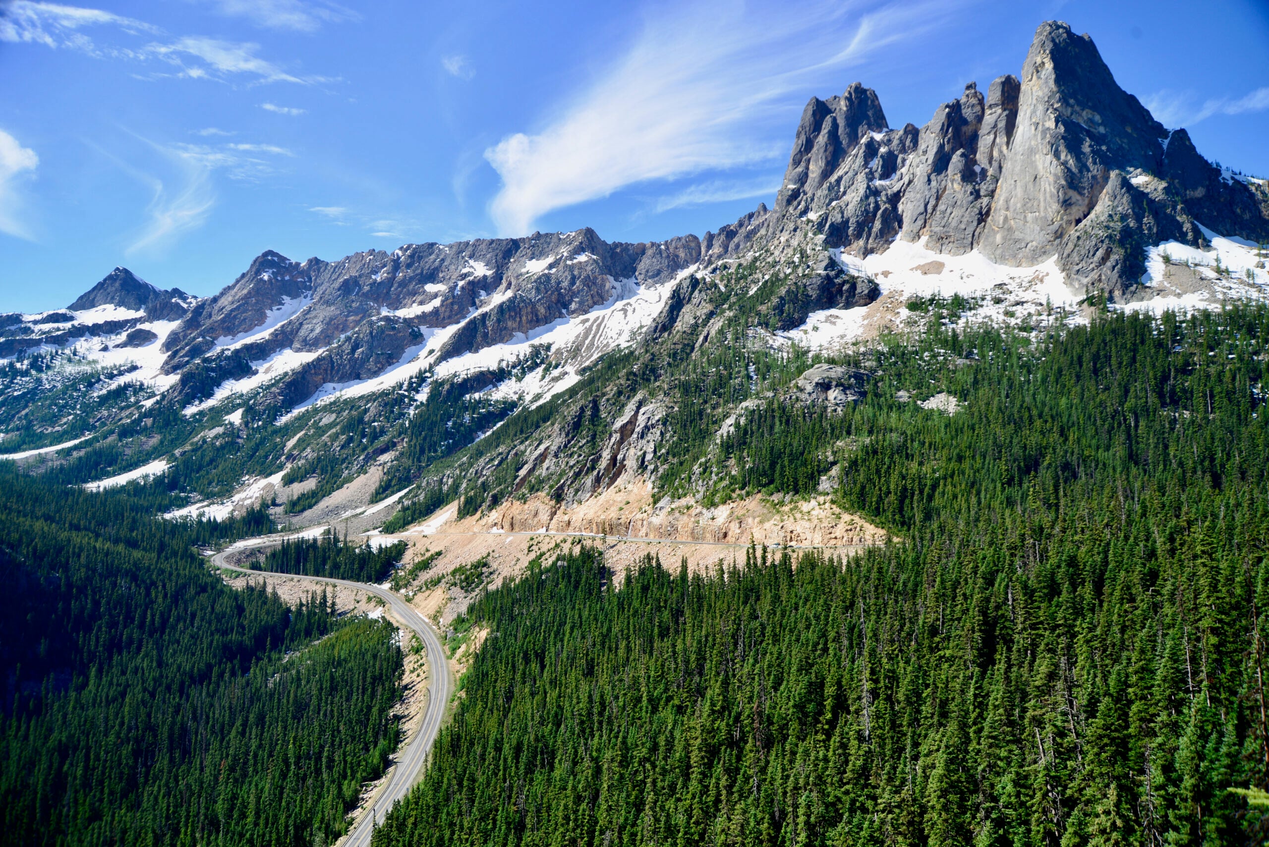
Washington Pass Overlook (Milepost 162, Elevation 5,477 feet)
This is the high point of the highway and one of the better overlooks in Washington State. Liberty Bell Mountain and the Early Winters Spires are directly ahead. The views are dramatic enough that people stop here regardless of any other motivation.
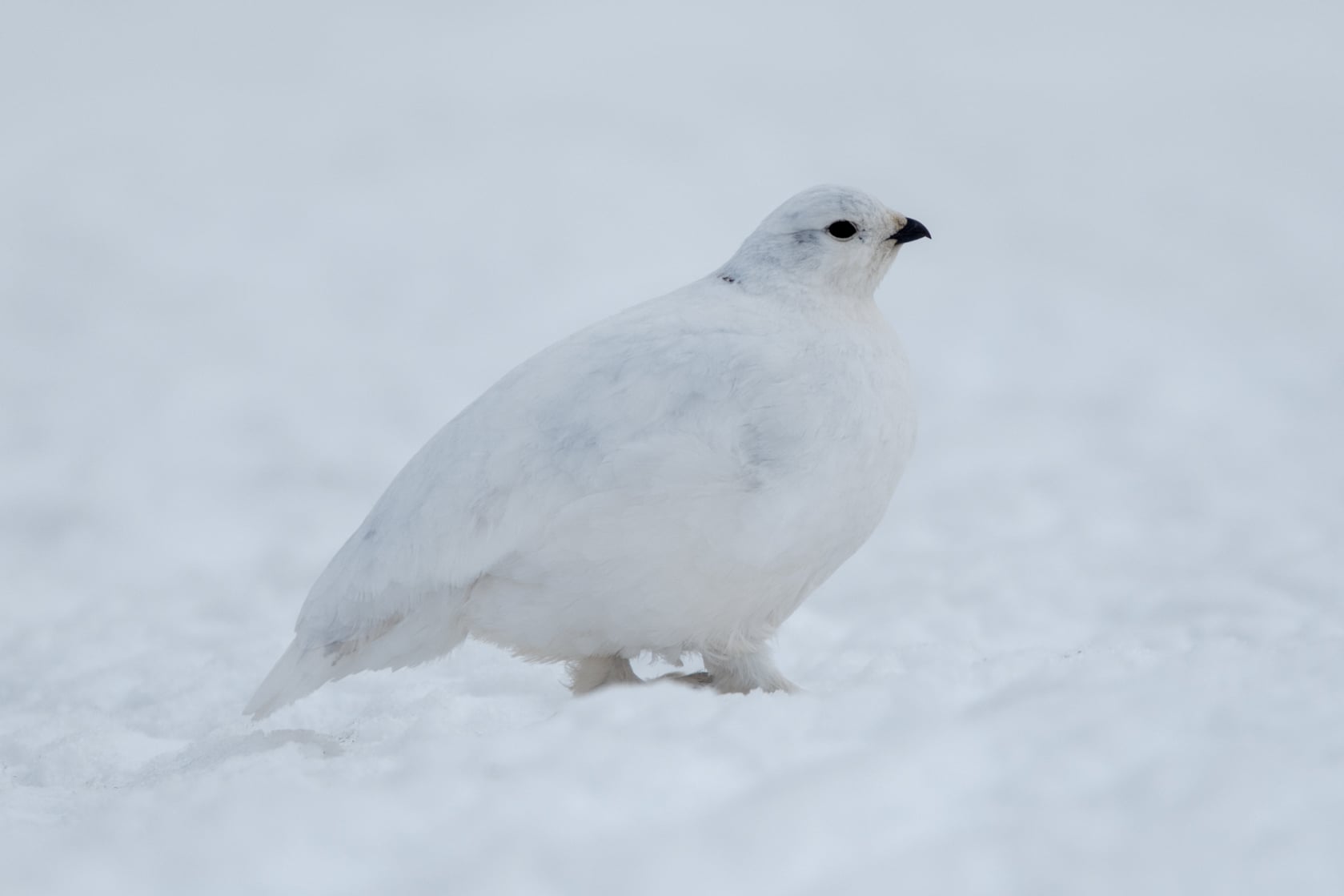
For birds: White-tailed Ptarmigan are on the rocky slopes above the overlook. They are camouflaged to an absurd degree, brown in summer against brown rock and lichen. You are more likely to almost step on one than to spot one from a distance. Walk the rocky areas above the parking lot slowly and scan carefully, particularly early in the morning.
Gray-crowned Rosy Finch is present on snowfields above the overlook in July and August, picking insects off the snow surface. Not common but findable with patience.
Clark’s Nutcracker is reliable here as well, often visible from the parking lot without any effort.
Mazama and Lost River Road (Milepost 179.5)
East of Washington Pass the landscape shifts. You drop out of the subalpine zone quickly. By Mazama you are in the Methow Valley: drier, more open, a completely different bird community.
Turn east on Lost River Road at milepost 179.5. Drive 2.5 miles and turn left into the lodge parking.
The property here is 22 acres of giant cedar, beaver ponds, and river. It is privately owned but open to birders. This is the best single birding stop east of the passes.
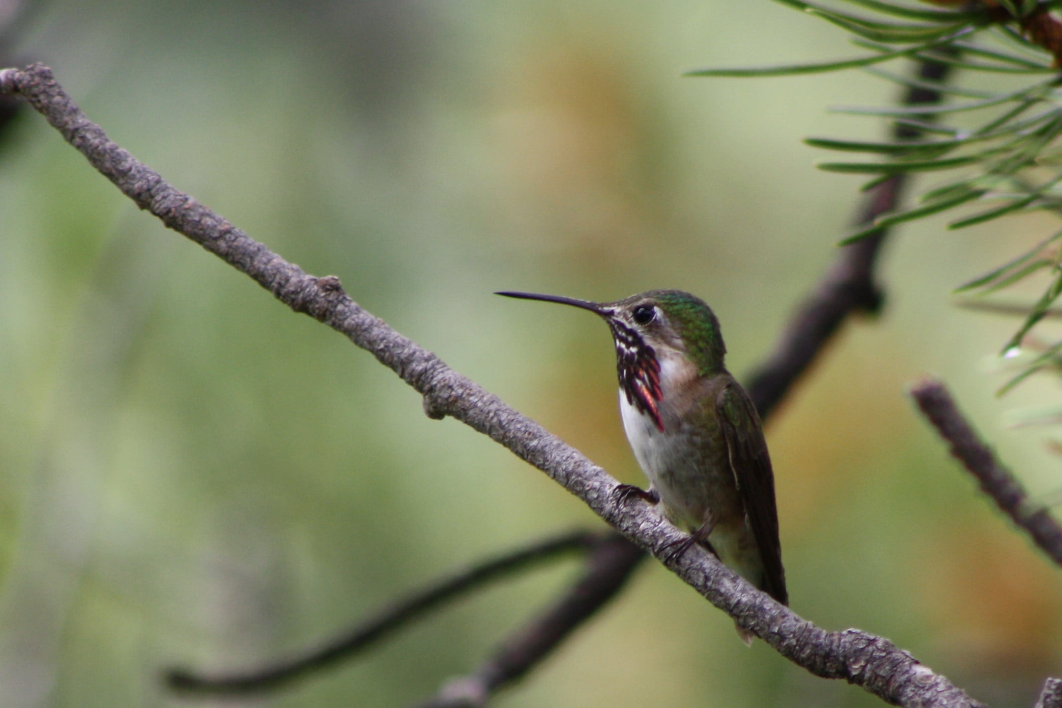
The Calliope Hummingbird is here in June and July. It is the smallest breeding bird in North America. Despite being barely larger than a large bumblebee, it breeds at high elevation in the Cascades and winters in Mexico. The Mazama area is one of the better places to see one in Washington. Watch any flowering shrub along the path or near the beaver pond.
Also here: Swainson’s Thrush, MacGillivray’s Warbler, Townsend’s Warbler, Williamson’s Sapsucker, Hammond’s Flycatcher, Dusky Flycatcher, Mountain Chickadee, and Northern Pygmy-Owl at dawn and dusk.
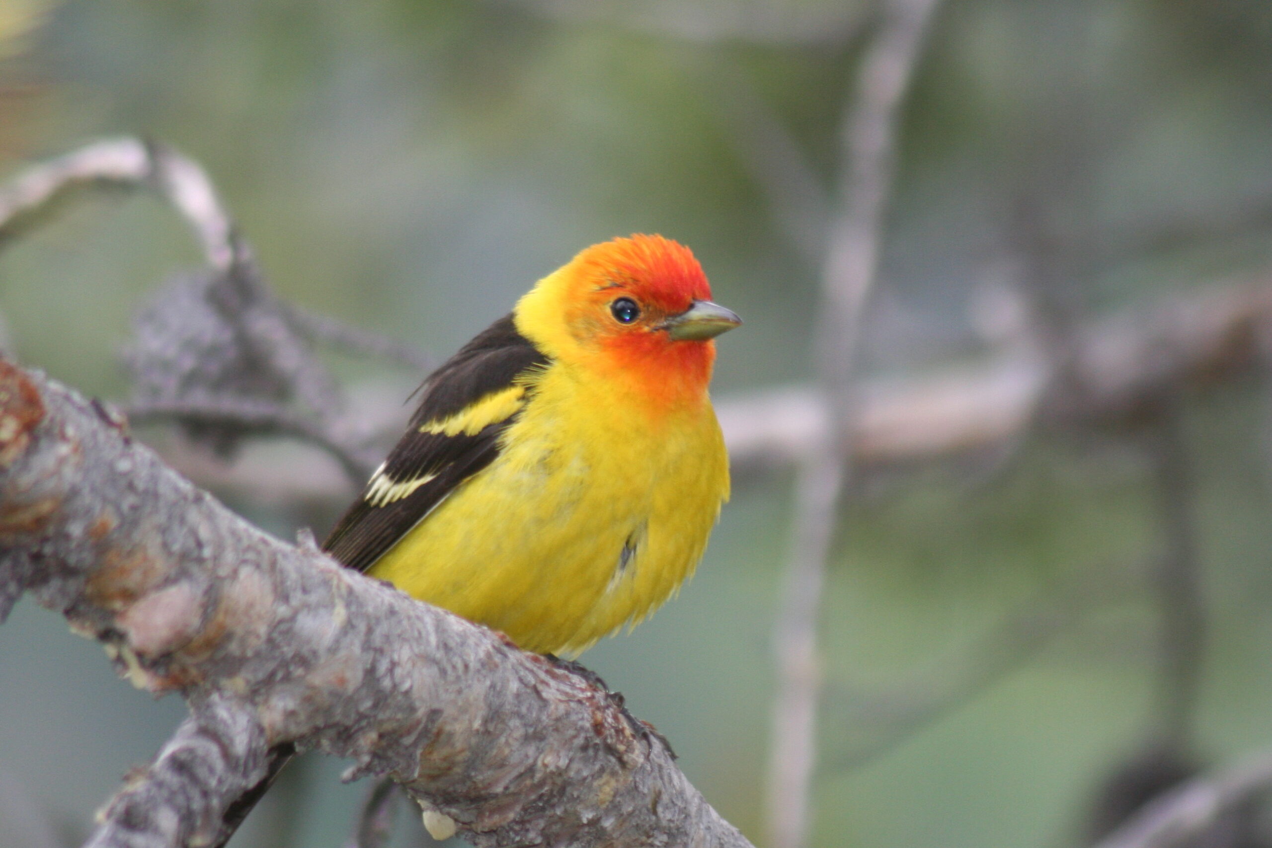
The Western Tanager is here in June. The male has an orange-red head and yellow body that looks like it belongs in a Costa Rican forest, not eastern Washington. It is here every summer.
Mountain Bluebird is possible on the open slopes east of Mazama, particularly along fencelines.
The Methow Transition: Winthrop and Beyond
By Winthrop you are in eastern Washington bird territory. The species mix reflects the drier, more open landscape.
Red-tailed Hawk and American Kestrel on the power lines. Western Meadowlark in the fields. You will hear the meadowlark before you see it: a loud, liquid, optimistic call that does not belong in the context of a scrubby Methow hillside and somehow fits perfectly. Loggerhead Shrike is possible in open shrub-steppe country along the valley floor.
Common Nighthawk is findable in Winthrop evenings in July. It is not a hawk and not related to any hawk. It swoops over town at dusk making a nasal “peent” call and catching insects on the wing.
The Methow River near Winthrop has good waterfowl in spring migration. Common Merganser is year-round. Tundra Swan stops briefly in spring.
The transition from west-side to east-side ecology happens in less than thirty miles on SR 20. That biological divide is part of what makes this drive worth doing as a birding road, not just a scenic one.
The Birds Worth Pulling Over For
If you are new to birding and have limited stops, build your day around these:
American Dipper. Gorge Creek (milepost 123) or Colonial Creek (milepost 130). North America’s only aquatic songbird, diving into fast water and walking along the bottom. Nothing else looks or acts like this. A guaranteed crowd-pleaser for non-birders.
Harlequin Duck. Late April and May, any fast-moving stream. The window is narrow. If you have never seen one in its element on white water, this is the moment.
Clark’s Nutcracker. Rainy Pass and Washington Pass. Loud, large, conspicuous, and will approach you. Easy to find, worth knowing.
Calliope Hummingbird. Mazama, June and July. Smallest breeding bird in North America. Worth the 45-minute detour on Lost River Road.
Three-toed Woodpecker. Rainy Pass. A genuine rarity across most of North America. At Rainy Pass, it is reliable with patience and the right dead-snag habitat.
Western Tanager. Mazama to Winthrop, June and July. You will not need help identifying it.
White-tailed Ptarmigan. Washington Pass overlook, above the parking lot. Patience and early morning required. Two out of twelve times is a reasonable success rate.
What to Bring
You do not need specialized gear for this drive. You do need a few things.
Binoculars. The 8×42 standard works fine. Even a cheap pair helps at Washington Pass. You will regret not having them at the ptarmigan slopes.
eBird app. Free. Load it before you lose cell service, which happens around Newhalem and does not return until Mazama. It shows recent reports at specific hotspots along the highway so you know what has been seen in the last week before you drive two hours to find it.
Gas. Fill up in Burlington or Marblemount on the west side. Mazama or Twisp on the east side. Nothing in between.
A road status check. wsdot.wa.gov/travel/real-time/mountainpasses/north-cascade-hwy. Takes 30 seconds. The highway can close unexpectedly for slides or late-season snow events even after its official opening.
Food and water. No services between Newhalem and Mazama. That is roughly 60 miles. Pack what you need for half a day.
Where to Stay
If you are doing this as a two-day trip, which is the right call for the full drive, the logical split is somewhere in the Methow Valley.
Mazama. The Mazama Country Inn and the Freestone Inn at Wilson Ranch are both within a few miles of the Lost River Road birding stop. Early Winters Campground is just east of Washington Pass for anyone who wants to be at the overlook at first light.
Winthrop. More options, more of a town. The Duck Brand Hotel is central. Sun Mountain Lodge is a step up and sits on a ridge above the Methow Valley with broad views. Either works as a base for the eastern half of the drive.
Marblemount or Rockport. If you want to be positioned for the Skagit Valley eagle viewing in winter, this is the right base. The Cascades Inn in Marblemount is the main option.
Frequently Asked Questions
Do I need to be an experienced birder to get something out of this drive?
No. The American Dipper, Clark’s Nutcracker, and Western Tanager are identifiable on sight by anyone who knows to look for them. The scenery alone justifies the drive. The birds make it better.
What is the single best stop on SR 20 for birding?
The Lost River Road habitat near Mazama at milepost 179.5 is the most species-rich single stop on the eastern half of the highway. For the western half, Gorge Creek near milepost 123 is the most reliable for the American Dipper, which is the bird that surprises people most.
When does the North Cascades Highway open in spring?
Historically, the high-pass segment opens somewhere between early April and late May. In recent years (2024, 2025), opening day fell in mid-to-late April. In heavy-snow years it can push into May. Check wsdot.wa.gov for real-time pass status before you go.
Can you see Harlequin Ducks on SR 20?
Yes, in April and May. They migrate from Puget Sound and the coast to breed in fast-moving streams in North Cascades National Park. They arrive in April. In years when the highway opens before mid-May, the timing overlaps and roadside viewing is possible at fast-moving creeks near Newhalem and Mazama. By early June they have dispersed to higher-elevation streams.
What birds are at Washington Pass?
White-tailed Ptarmigan on the rocky slopes above the overlook, Clark’s Nutcracker in the parking area, and Gray-crowned Rosy Finch on the snowfields in July and August. The Three-toed Woodpecker is at nearby Rainy Pass (milepost 160).
Is there a birding map for the North Cascades Highway?
Yes. Audubon Washington produces the Great Washington State Birding Trail Cascade Loop map, which covers SR 20 specifically. The North Cascades National Park Visitor Center in Newhalem also distributes a bird finding guide. The eBird app shows reported hotspots along the highway with recent sightings.
What is the Calliope Hummingbird and where do I find it on SR 20?
The Calliope Hummingbird is the smallest breeding bird in North America. Despite weighing about as much as a penny, it breeds at high elevation in the Cascades and migrates to Mexico for winter. The Mazama area near milepost 179.5, specifically along Lost River Road, is one of the better places in Washington State to see one. June and July are the months.
Do the campgrounds along SR 20 require reservations?
Yes. Campgrounds within North Cascades National Park including Colonial Creek, Newhalem Creek, and Gorge Lake are bookable through Recreation.gov. Sites fill quickly for summer weekends, especially in July and August. Book as early as possible if you plan to stay overnight. Day use areas do not require reservations.
SR 20 is one of the few drives in Washington where the bird community changes completely every 30 miles. You move from Skagit Valley riparian species to old-growth forest specialists to glacial-lake waterbirds to subalpine woodpeckers to high-alpine endemics to dry Methow Valley east-side birds, all in a single day.
That transition is what makes it worth doing as a birding road, not just a scenic one. The highway does the elevation work. You just stop when something moves.
For everything else the park offers, our North Cascades National Park guide covers the full picture.
- About the Author
- Latest Posts
Explore Washington State has been covering the real Washington for more than a decade. State parks, small towns, back roads, rest stops, and the people who make this place worth exploring. What started as a hyperlocal project covering individual communities grew into a full media project with more than 340 podcast episodes, a weekly newsletter with over 4,800 subscribers, and coverage of all 146 Washington State Parks. The content here comes from people who have actually been to these places: locals, regulars, and lifelong Washington residents who care more about getting it right than getting clicks.