Hiking in Moulton Falls Regional Park
Moulton Falls Regional Park is a hidden gem in southern Washington, nestled in a heavily forested area just outside of Battle Ground in Clark County. Clocking in at just about a 45-minute drive from the Vancouver and Portland area, it’s close enough to be an easy post-work adventure or a day trip from other parts of Washington.
Planning a trip to Vancouver? Start with our complete Vancouver Visitor Guide →
[toc]
Moulton Falls Regional Park in East Fork Lewis River
Moulton Falls is a 387 acre park, at the junction of the East Fork of the Lewis River and Big Tree Creek in Clark County, it features two waterfalls and a swing bridge in an arch form that is more than three stories high.
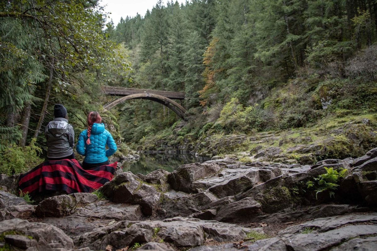
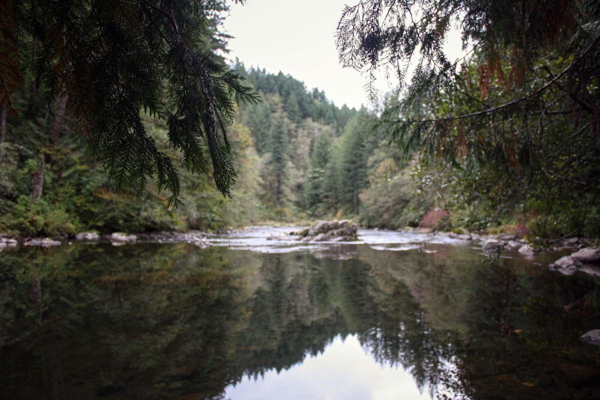
Moulton Falls Regional Park sits along the river, making it a beautiful, spectacular and picturesque view. The spectacular view of the Lewis River flows within a narrow tree-lined canyon, and on the other side, the river peacefully flows towards Moulton Falls.
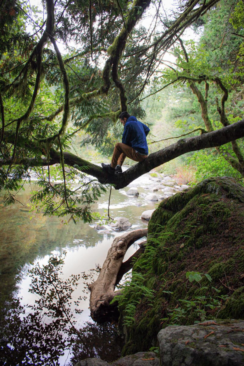
While the summer sees larger crowds flocking to the watering hole near the large pedestrian bridge, fall is a better time to visit for some solitude, whether you’re strolling around enjoying the waterfalls or going for a trail run on the nearly six-mile-long trail. With a large amount of tree cover, there’s a good chance you’d even be able to avoid the rain on a drizzly day. The whole Moulton Falls Regional Park wraps both sides of the East Fork Lewis River. The trailhead for Bells Mountain Trail also begins within the 387 acre Moulton Falls Regional Park, which is a whole adventure in and of itself! Take a peaceful stroll with a bit of adventure as you climb the Bells Mountain Trail.
Explore Moulton Falls Regional Park in Clark County Washington State and be amazed by its magnificent, worth wandering scenic views. Its tourist destinations included volcanic rock formations from early lava flows, historic Indian meeting grounds, a swing bridge on Big Tree Creek and access to the 7.5-mile Bells Mountain Trail. Join us as we explore this beautiful area in Washington State!
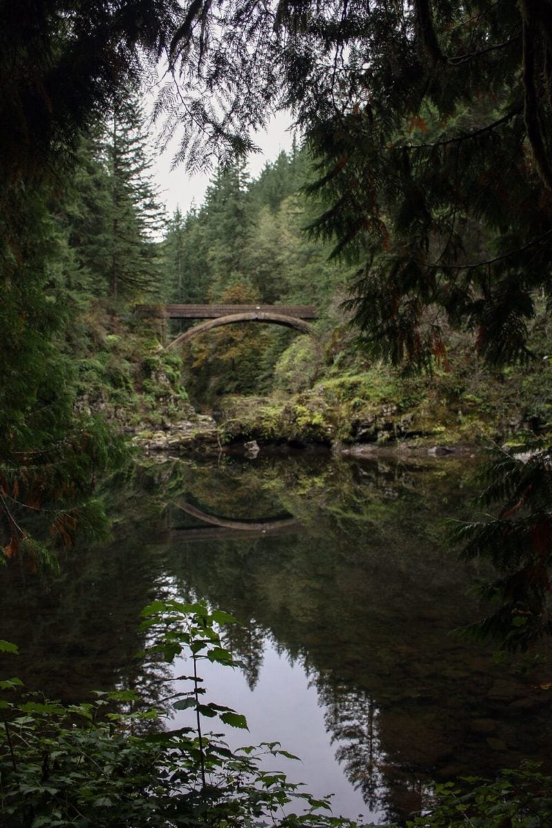
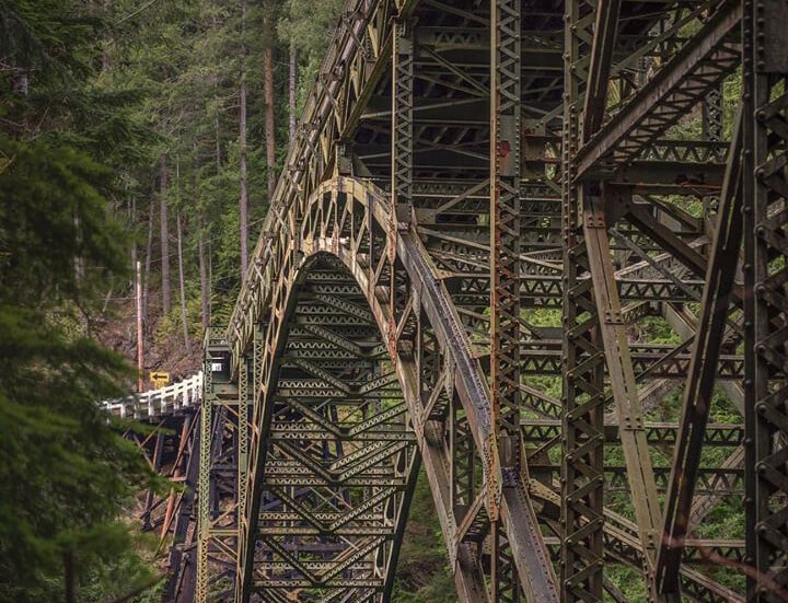
Moulton Falls Arch Bridge
The most recognizable area at the Moulton Falls Regional Park is the scenic, picture-perfect arch bridge. It traverses across the river, reaching a height of about 60 feet. While you can’t jump off the swing bridge, many people use the surrounding, much lower rocks around it to get into the river on a hot day. From the parking lot, the wide and well-used trail puts you at the edge of the water with a perfect view of the arch bridge. It’s definitely the best spot for photos, especially on a calm day when the water is reflecting all the surroundings in the heavily forested regional park. Bring a picnic blanket and some snacks and sit and enjoy the views herein Moulton falls. In the fall when the leaves change, it’s a beautiful area to bundle up and relax, and in the summer it’s great for people-watching beautiful scenery.
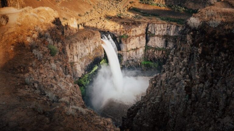
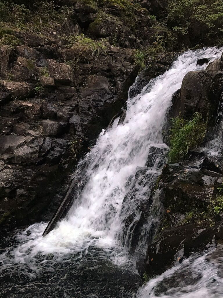
Yacolt Falls in Moulton Falls Regional Park
If you continue following the trail, it will take you out across Lucia If you continue following the Bells Mountain Trail, it will take you out across Lucia Falls Road and back into the woods on the other side. Take a very short, flat hike through the trees and you will arrive at Yacolt Falls.
At only 28 feet tall, it’s short as far as Pacific Northwest waterfalls go, but that doesn’t stop it from being a good subject for some photographs! The pool just underneath the waterfall is another popular spot for swimming for those that venture away from the main attraction on the other side of the road. A small bridge takes you across the falls back up to the road, but if you want a little more adventure, there’s another option to the west.
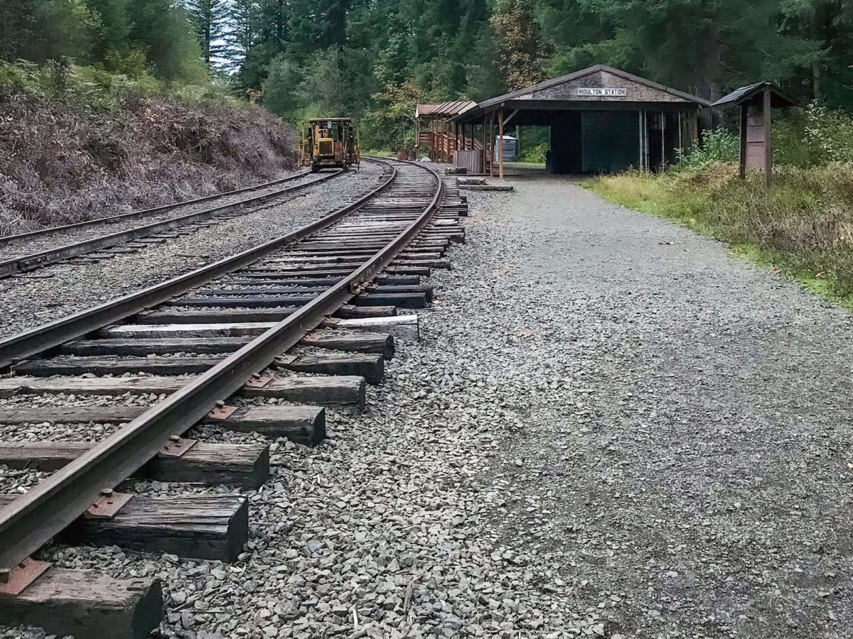
Moulton Station
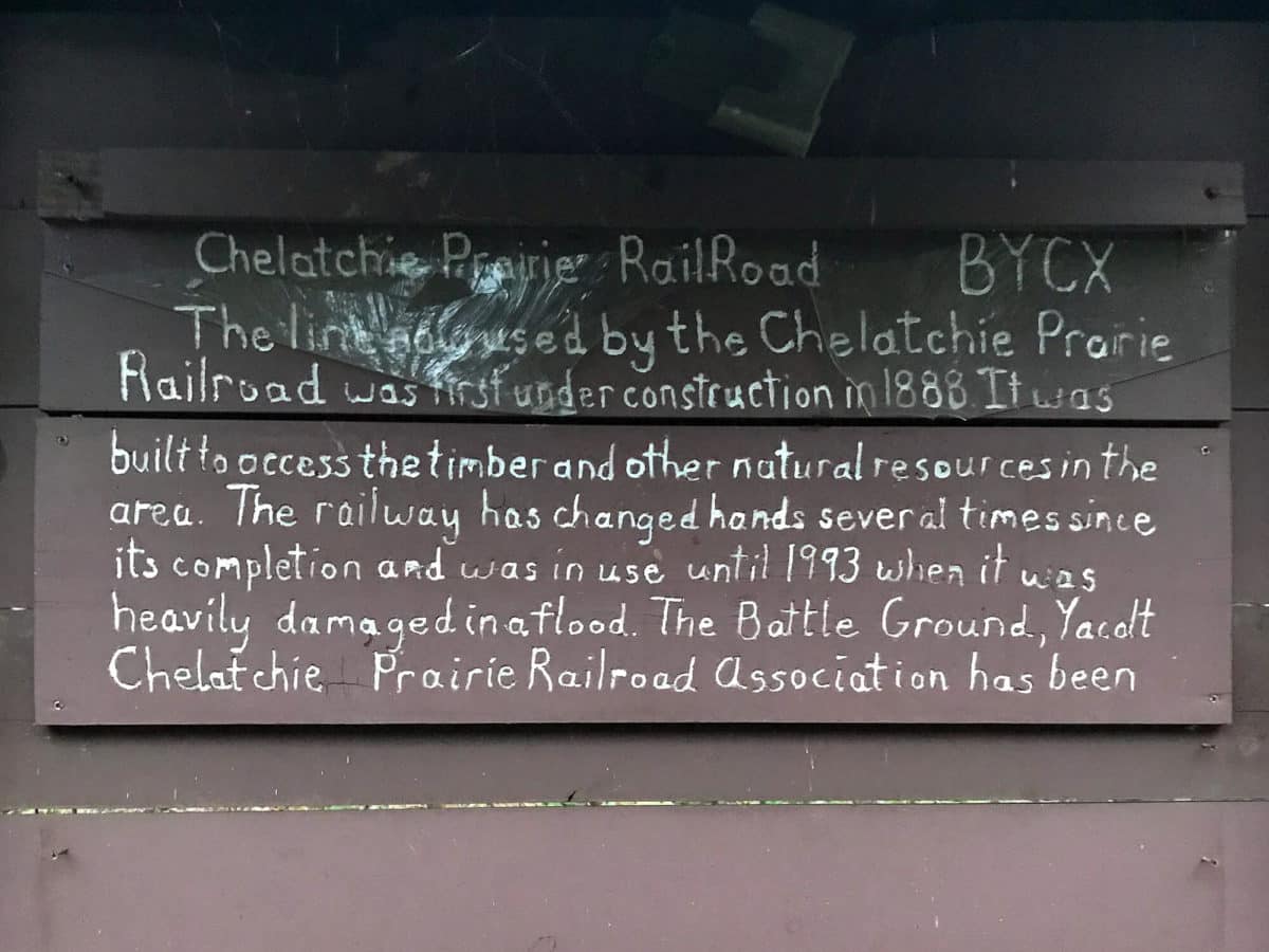
Hopping on the small side trail just up from Yacolt Falls, you’ll emerge from the woods at an old railroad track and Moulton Station. The Chelatchie Prairie Railroad Excursion Train runs through the Moulton Falls Regional Park and was once used for freighting timber, but no longer. On one weekend a month and around the holidays, you can hop on the steam locomotive for a sightseeing tour of the railroad, but most days the railway sits empty of trains and is open for exploring! You can walk along the trestle until you reach the No Trespassing signs, and cross your fingers that you might see some wildlife in this slightly more remote area of the regional park.
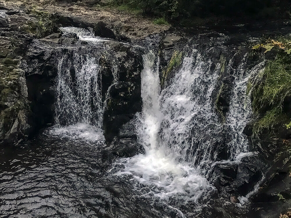
Once you’ve had your fill of the old Chelatchie Prairie Railroad Excursion Train Station, you can continue back the way you came to the park’s namesake, Moulton Falls. Without hiking much, you can view the Moulton Falls from the main parking area in just a few quick steps, but it’s definitely worth wandering the trail in this area if you have time. Moulton Falls itself is only ten feet high, but very picturesque pouring through the volcanic rock formations around it.
Parking & Trailhead
As for logistics, there is a small, main parking lot along the highway as well as an overflow lot a little further east. Be careful of parking on the shoulder of the Moulton Falls highway – it’s not allowed in a lot of areas along the road. After a couple of hours of strolling through the woods, it’s a quick drive to head into Battle Ground for some pizza and brews! But most importantly, enjoy this beautiful area that you might get lucky enough to have all to yourself!