Conquering Mount Storm King
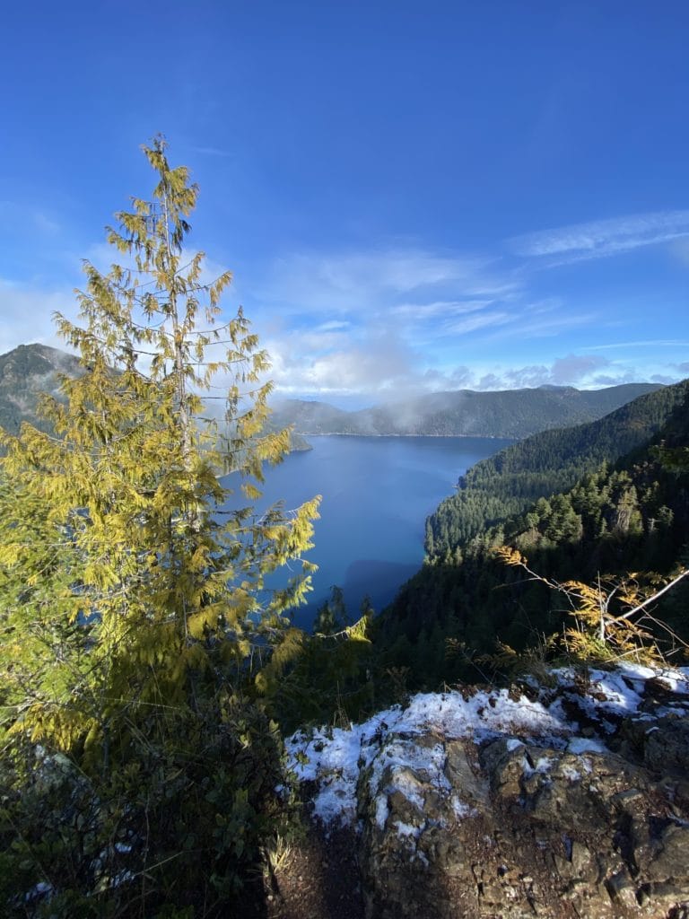
Mount Storm King in the Port Angeles area of Olympic National Park boasts one of the most incredible views in Washington. Climbing 2,000 feet above Lake Crescent, you can see almost the entire pristine blue lake, northern views of the Olympic Mountains, the San Juan Islands and Vancouver Island. My husband and I first tackled Mount Storm King several years ago, and since then, we’ve wanted to return. The views are that great! We recently hiked it again in early March, when there was hardly any snow.
Quick Info
Location: 20 miles southwest on Highway 101 from Port Angeles.
Pass required: None.
Hiking distance: 4-5 miles roundtrip.
Difficulty: Strenuous, but short. The (optional) ropes section to reach the summit requires you to be steady on your feet.
Gear needed: The Ten Essentials (always!), good footwear (boots or trail runners) and lots of water!
Starting Out
You will start from the Storm King Ranger Station, where there is plenty of parking and serviced restrooms (yay!). Follow the trail toward Marymere Falls for about a half-mile until you reach the marked trailhead for Mount Storm King on your left. Enjoy the lush flat trail here, because as soon as you split off, it gets steep!
Mount Storm King Trail
Over the next two miles, you will quickly gain 2,000 feet of elevation. We started our ascent wearing multiple layers of clothing and quickly stripped down to our base layers a quarter of a mile in. This hike gets you sweating!
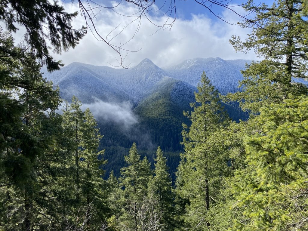
The trail is well-maintained and beautiful. You will follow a series of switchbacks and meander through dense forest that thins with elevation gain. There are plenty of great views of the surrounding hills and mountains as you ascend. Look for Marymere Falls amongst the trees as you climb — it looks tiny in the distance.
About one and a half miles in, you get your first good look at Lake Crescent. Congratulations: the most grueling part of the hike is over (in my opinion!). You’ll hike along the ridgeline and through a few more short switchbacks with lots of great views intermixed. Look for a sign indicating the end of the maintained trail. If you’re afraid of heights (or birds — read on!), this is a great stopping point with still-fantastic views of the lake.
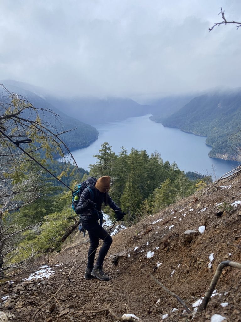
The Ropes
When deciding whether to climb to the real summit of Mount Storm King, consider a few things: You and your hiking partners’ abilities and limits. Trail conditions. That anything you climb up, you must also climb down. The ropes were in good condition both times we climbed Mount Storm King (May 2019 and March 2021), but of course, that’s always subject to change.
Both times we hiked this trail, there were five ropes in total. The first rope covers the steepest and trickiest section (think: sliding gravel, no footholds). The key here is to commit — keep moving toward the tree to which the rope is anchored. Once you’ve made it to the tree, stop to catch your breath and enjoy the amazing view. The following ropes are shorter and have some decent footholds.
Note: As the trail becomes more crowded later in the day, getting through the ropes can take quite a long time since it is only safe for one person to be on each section at a time. Generally, I have seen hikers heading uphill yield to hikers descending the ropes, opposite of typical trail etiquette.
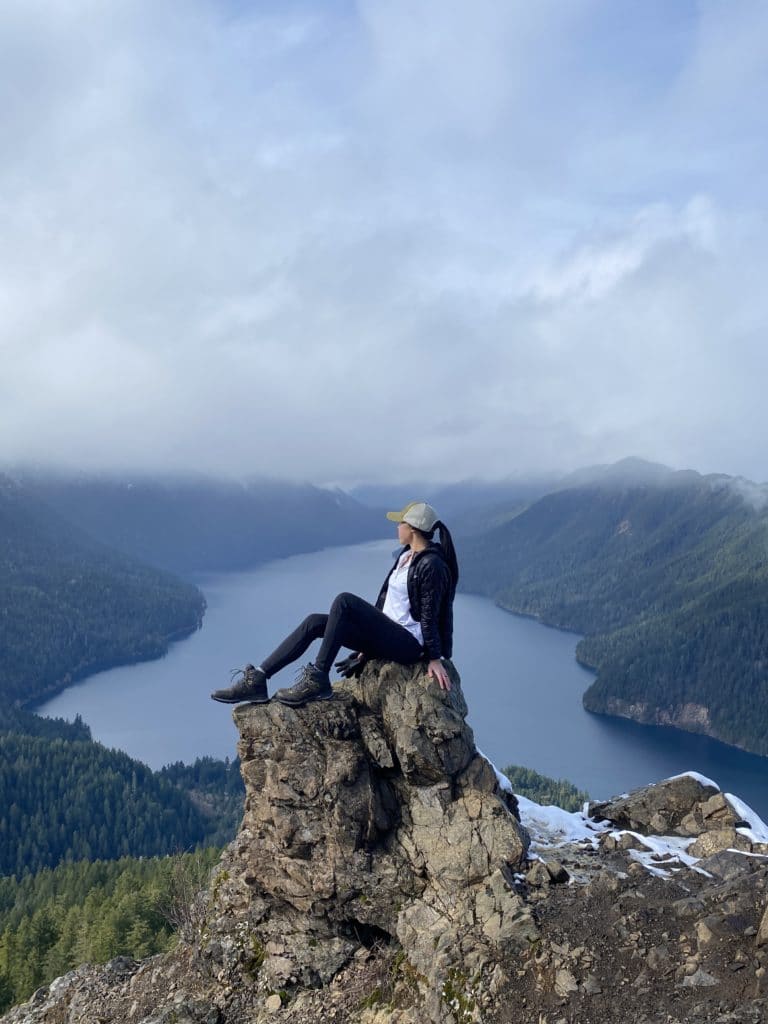
Mount Storm King Summit
After the final rope, climb over some rocks to be rewarded with an incredible view. Look for the Strait of Juan de Fuca and the San Juan Islands on a clear day. It’s amazing to see how close Lake Crescent is to ocean waters! Make sure you get your iconic photo on The Rock. Though it was mostly clear both times we went, I’ve seen some amazing photos from here on a foggy day or at sunset.
A word about the birds: When a small crowd of hikers has formed at the summit, a posse of Canada jays usually swoops in. They will land on your outstretched hand and often won’t fly away. The jays are cute and non-aggressive, just persistent. Please do not feed the birds. Feeding wildlife damages their health, alters natural behaviors, and exposes them to predators and other dangers according to Leave No Trace Principles).
The Descent
Though the ropes have a thrilling reputation, I didn’t think they were too crazy. Take your time while descending. It’s best to turn around and face the hill as you hold on to the rope, even if walking backward is a little scary.
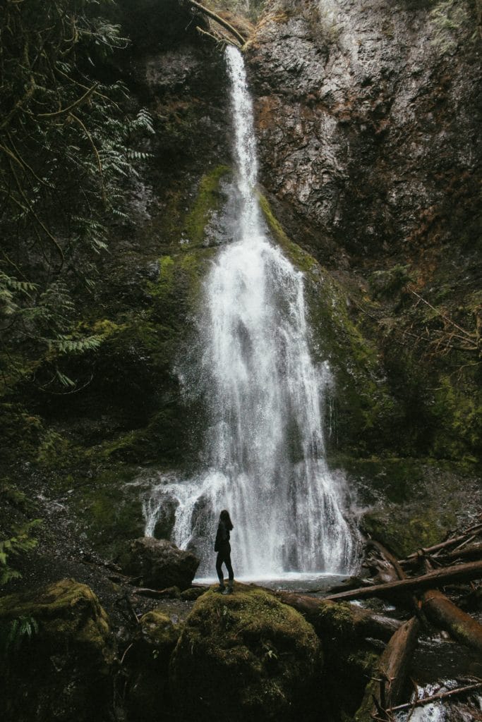
This trail gets my legs shaking and knees weak by the time I’m back to the trailhead! If you have a little left in you, though, I recommend taking a quick and easy detour to Marymere Falls for some post-hike refreshment.
Recommendations
- Check the weather for Port Angeles — or even better, Fairholme — before making the drive out. A clear or partly clear day is best for the view and for safety.
- Begin your hike early (before 10 a.m.). This pays off when you avoid the crowds — and the pressure of a line of hikers behind you — at the ropes section.
- Bring a light windbreaker, even in the summer. It’s pretty windy at the summit.
For more info about this trail, visit the Washington Trails Association site.