
Steamboat Rock State Park
Region
NCW
Fifteen thousand years ago, the thing you are looking at was the lip of a waterfall twice the height of Niagara. The Ice Age floods sent a lake the size of Lake Ontario through the Grand Coulee at 50 miles per hour, and everything around Steamboat Rock eroded away. The rock did not. It is still here, 800 feet above the water, with 600 acres of flat plateau on top.
The park is 5,043 acres on a peninsula at the north end of Banks Lake. 50,000 feet of freshwater shoreline. 162 campsites in the main campground with full hookups available. Primitive camping at Jones Bay and Osborn Bay. Seven boat launches. A sandy swimming beach. And a summit hike that puts you on top of a piece of geology that is hard to believe until you are standing on it. Open year round.
Who this park is not for: If you do not like heat, wind, or exposed terrain, this park will test you. Summer days regularly hit the upper 90s with no shade anywhere near the water or on the summit hike. The wind comes up most afternoons and it is not gentle. Tent campers who do not stake down lose canopies and pop up shelters regularly. If you want a shaded, mild, western Washington camping experience, this is the opposite of that. If you are good with desert heat and want a lake big enough to disappear on, keep reading.
At a Glance
| Detail | Info |
|---|---|
| Location | 51052 Highway 155, Electric City, WA 99123 |
| Phone | (509) 633-1304 |
| steamboat.rock@parks.wa.gov | |
| Size | 5,043 acres |
| Shoreline | 50,000 feet on Banks Lake |
| Season | Year round (reservable April 1 through October 31; first come, first served off season) |
| Hours | 6:30 AM to dusk |
| Entry | Discover Pass required ($45/year or $10/day) |
| Reservations | Yes, Washington State Parks reservation system |
| Pets | Dogs allowed on leash |
| Fires | Allowed in designated fire pits and grills; check current burn ban status |
Getting There
From Seattle, take I-90 east to Highway 17 north, then Highway 155 north to the park. About 230 miles, roughly three and a half hours. The park entrance is 11 miles south of Electric City and 16 miles north of Coulee City on Highway 155.
From Spokane, take Highway 2 west to Highway 174, then south on Highway 155. About 100 miles, roughly two hours.
From Wenatchee, take Highway 2 east to Highway 17 north, then Highway 155. About 90 miles, roughly two hours.
Camping
The park has three tiers of camping: a full service main campground with hookups, two primitive campgrounds to the north, and boat in sites on Banks Lake.
Main Campground
162 campsites across four loops. Full hookup sites have 20/30 amp electric, water, and sewer. Each site has a picnic table, fire ring, and grill. Asphalt pads. Maximum length 50 feet (limited availability). Pull through and back in options.
| Site Type | Count | Details |
|---|---|---|
| Full hookup (water/electric/sewer) | 136 | 20/30 amp service |
| Standard (no hookups) | 26 | Tent and smaller RV |
| Cabins | 3 | Queen futon, bunk bed, heater, A/C |
| Hiker/biker | 5 | First come, first served |
Restrooms and showers: Five restrooms (four ADA accessible) with flush toilets. Six showers (four ADA accessible). Showers are free. Dump station available ($5/use).
Which Loop to Pick
Four loops in the main campground, each with a different feel.
52 Things to Do at Washington State ParksA free printable checklist: one adventure per week for a full year.
Get the Free Checklist- Cove Loop. The newest addition. 30 sites with the best infrastructure in the park. Paved ADA accessible paths connect to the marina. If you are booking for the first time and want a clean, well designed site, start here.
- Sage Loop. Good separation between sites and direct views of Steamboat Rock from several pads. Site 11 is a favorite. More grass and trees than the other loops. The best balance of views and privacy.
- Bay Loop. Waterfront adjacent sites on the outside of the loop. The trade off is less privacy. Sites near the trail get foot traffic. Good for people who want to be close to the water and do not mind neighbors.
- Dune Loop. Closest to the playground, basketball court, and concession stand. The family loop. Convenient for kids but noisier than Sage or Cove.
Cabins
Three furnished cabins in the main campground. Each has a queen futon, bunk bed, electric heater, and air conditioning. A/C matters here. Summer nights stay warm.
Primitive Campgrounds
Two primitive campgrounds are located seven miles north of the main park on Highway 155. Both are first come, first served. No water. Vault toilets. Picnic tables and fire rings.
| Campground | Sites | Details |
|---|---|---|
| Jones Bay | 44 | Primitive. Vault toilets. No water |
| Osborn Bay | 36 | Primitive. Vault toilets. No water |
These are a completely different experience from the main campground. Quieter, more remote, no services. Bring everything you need including water. Good for people who want solitude and do not mind roughing it.
Boat In Sites
12 primitive campsites accessible only by boat, north of the main campground launch. Vault toilets. No water. First come, first served. If you have a kayak and want to camp where nobody else is, this is the option.
Campsite Fees
| Period | Standard | Full Hookup |
|---|---|---|
| Peak season | ~$35 | $45 to $51 |
| Shoulder/off season | Lower rates apply | Lower rates apply |
Plus $8 reservation fee. Check the Washington State Parks reservation system for current rates.
Reservation Tips
Summer fills fast. The park is nearly full every Friday and Saturday from Memorial Day through Labor Day. Book as early as your window opens. Shoulder season (April, May, September, October) is reservable and more realistic for last minute plans, but even May weekends can sell out. A camper who booked six weeks ahead in May reported very limited site selection.
Trails
Two primary trails. The summit hike is the signature experience. Northrup Canyon is the quieter alternative with completely different terrain.
Steamboat Rock Summit Trail
6.0 miles round trip (full perimeter loop). 650 feet of elevation gain. Summit elevation 2,312 feet. Moderate. Three to four hours for the full loop.
The park's signature hike. A sandy path leads to the base, then the trail climbs steeply up basalt scree to the summit plateau. The ascent is short but aggressive. Loose rock, no switchbacks, no shade. Once on top, the plateau opens to 600 acres of flat terrain with wildflowers in spring (balsamroot and lupine) and 360 degree views of Banks Lake, the Grand Coulee, and the surrounding desert cliffs.
The trail forks on top into a northern loop (3 miles) and a southern loop (2.5 miles). The northern loop runs close to cliff edges with no guardrails. The southern loop trail can be harder to follow. Bring a map or GPS.
If you just want to reach the top and turn around, the round trip is about 2.5 miles. But the perimeter walk is why people come. The scale of the plateau is hard to grasp until you are up there. Read Conquering Steamboat Rock for a firsthand account of the hike.
Safety. No shade on the entire trail. Rattlesnakes are present. Cliff edges are unprotected. Summer temperatures on the exposed rock can exceed 100 degrees. Hike early morning or skip it on the hottest days. Bring more water than you think you need.
Northrup Canyon Trail
6.1 miles round trip (to Northrup Lake and back). 793 feet of elevation gain. Moderate. Two and a half to three hours. Shorter option: 3.4 miles round trip to the homestead with only 180 feet of gain.
A completely different hike from the summit trail. Northrup Canyon contains the only forest in Grant County. The trail follows a creek through a canyon of ponderosa pine, aspen, and sagebrush. About 1.5 miles in, you reach the Northrup homestead, an 1890s farmhouse, barn, and chicken coop built by John Northrup, who settled the canyon in 1874 and planted the area's first orchard. The structures are still standing.
The canyon is one of the best bald eagle sites in eastern Washington. Over 200 eagles roost in the trees here during winter months. Even in other seasons, raptors are common. This is the birding hike.
The trailhead is at the end of Northrup Canyon Road, 0.7 miles off Highway 155, directly across from the Northrup Point day use area and boat launch. An equestrian campground is also available at Northrup Canyon by reservation. Call (509) 633-1304.
Paved Bike Path
A paved multi use path connects the campground loops to the marina, beach, and day use areas. Not a hiking trail. Good for bikes and strollers. Makes getting around the main campground easy without driving.
Activities
On the Water
- Swimming. Sandy beach with a designated swim area on Banks Lake. No lifeguards. The lake is a reservoir fed by the Columbia River, so it warms up more than you expect for eastern Washington. Comfortable swimming by late June. The beach is the social center of the park on summer weekends.
- Boating. Seven watercraft launches at three locations with 320 feet of dock. Banks Lake is 27 miles long. There is room. The Northrup Point launch operates 24 hours. Crown Point stays open through the Grand Coulee Dam laser light show for evening launches. Plan for afternoon wind on open water. It comes up fast and the lake is fully exposed.
- Kayaking and paddleboarding. Banks Lake has coves, islands, and cliff walls that make for good exploring by paddle. Morning is the best window before the afternoon wind picks up. The marina area is the easiest launch point from the main campground. See our guide to kayaking in eastern Washington for more spots on the water.
- Fishing. Banks Lake is productive. Walleye, smallmouth bass, largemouth bass, and perch are the primary species. Washington State fishing license required. The walleye fishing draws people from across the state.
- Boat in camping. 12 primitive sites north of the main launch. See the Camping section above.
On Land
- Hiking. Two primary trails. See the Trails section above. The summit hike and Northrup Canyon are different enough that doing both on the same trip is worth the time.
- Bird watching. Northrup Canyon is the destination. Over 200 bald eagles roost there in winter. Year round, look for sage thrashers, horned larks, kestrels, and other raptors. The canyon is the only forested habitat in the county, which concentrates birds in a way that open desert does not.
- Biking. Paved paths connect the campground loops. Flat, easy, good for kids. Not a mountain biking destination but useful for getting around the park.
- Rock climbing. The basalt columns on Steamboat Rock draw climbers. This is not a developed climbing area with bolted routes. Know what you are doing.
- Horseback riding. Equestrian trails and an equestrian campground at Northrup Canyon. Call the park to reserve.
- Playground and courts. Basketball court, volleyball court, and playground in the main campground area near Dune Loop. The playground is a draw for families.
- Ranger programs. Interpretive walks and talks scheduled seasonally, including guided hikes in Northrup Canyon. Walk with a Ranger events are posted on the park's event calendar.
On Site Services
| Service | Season | Details |
|---|---|---|
| Lake Craves | Memorial Day through Labor Day, daily | Prepared food, espresso, ice cream, firewood, bagged ice. 9 AM to 8 PM. Delivery to campsites available starting at 6 PM |
Good to Know
- Wind. This is the single most important practical detail. Afternoon winds are strong and consistent. They come up fast. Canopy shelters, pop up tents, and anything not staked or weighted down will blow away. This is not an exaggeration. Secure your camp before you leave for a hike.
- Heat. Summer highs regularly reach the upper 90s. The main campground has some shade trees but the beach, the summit trail, and the day use areas are fully exposed. Bring sunscreen, hats, and drink water constantly. Hike early.
- Mosquitoes. Summer evenings bring them. Campers consistently recommend strong insect repellent and a mosquito net hat. The marina area and waterfront sites tend to be worse.
- Cell service. AT&T is the most reliable with 4G/5G. Verizon is variable (1 to 3 bars). T-Mobile 4G is limited. The basalt formations north of the campground block signal in some areas. Sites 112 through 118 on the east side get better reception. Do not count on reliable data for streaming or work.
- Nearest groceries. Electric City is 11 miles north. Small town, basic supplies. For a full grocery run, Grand Coulee is about 15 miles north. Plan your cooler before you arrive.
- Gas. Electric City or Grand Coulee. Fill up before heading to the park.
- Grand Coulee Dam laser light show. Free nightly show projected onto the dam face, running Memorial Day through September. The Crown Point boat launch stays open for evening access. About 15 minutes from the park. Worth seeing once.
- Dry Falls. 16 miles south at Sun Lakes-Dry Falls State Park. A visitor center overlooks what was once the largest waterfall in the world during the Ice Age floods. Three and a half miles wide, 400 feet tall. It is dry now. The visitor center explains the geology. Pairs well with the Steamboat Rock summit hike for understanding the scale of the floods that shaped this landscape.
A Bit of History
Steamboat Rock is not actually a rock. It is a mesa. Its width exceeds its height. The basalt that forms it was laid down roughly 16 million years ago by massive lava flows. Beneath that basalt sits granite that is 100 million years old. The gap between those two layers represents an immense span of erosion.
About 15,000 years ago, the Okanogan Lobe of the Cordilleran Ice Sheet blocked the Columbia River and diverted it through the Grand Coulee. When the ice dam holding back glacial Lake Missoula failed repeatedly, floodwaters moving at 50 miles per hour and carrying 9.4 cubic miles of water per hour carved the coulee deeper with each event. Everything around Steamboat Rock eroded. The mesa survived because its basalt was harder than the surrounding material. It faced into the floodwaters like the prow of a ship.
Banks Lake did not exist until 1953. When the Grand Coulee Dam project was complete, water was pumped from the Columbia River into the upper coulee, flooding the valley floor and creating a 27 mile reservoir. As part of the transfer, the US Department of the Interior and the State of Washington signed a Memorandum of Agreement handing responsibility for fish, wildlife, and recreation on nearly 45,000 acres of surrounding federal land to the state. The Washington State Parks and Recreation Commission took primary responsibility for over 1,200 acres encompassing Steamboat Rock. The park was formally dedicated on June 20, 1964, by Governor Albert D. Rosellini.
The park grew significantly after that. In 1972, the Parks Commission identified Northrup Canyon as a priority acquisition. The private Bullitt Foundation stepped in, purchased parcels from eight separate property owners, and on July 27, 1976, donated 1,862 acres in the canyon to the state. An additional 773 acres of federal land in the canyon that had never passed into private ownership were leased to the commission the same year. When the original Memorandum of Agreement was renewed in 2007, the acreage under state management nearly doubled, bringing the park to over 5,000 acres, one of the largest in the Washington State Parks system.
John Northrup settled in the canyon that bears his name in 1874, set up his own irrigation, and planted the first orchard in the area. His homestead structures from the 1890s are still standing on the Northrup Canyon trail.
This land sits within the traditional territories of Sahaptian and Interior Salish peoples, whose present day descendants include members of the Confederated Tribes of the Colville Reservation and the Confederated Tribes and Bands of the Yakama Nation.
Fees
| Fee | Amount |
|---|---|
| Discover Pass (annual) | $45 |
| Discover Pass (one day) | $10 |
| Watercraft launch | $7/day |
| Trailer dump | $5/use |
| Overnight unattended vehicle | $10/night |
Campsite fees vary by type and season. Check the Washington State Parks reservation system for current rates.
Nearby
- Grand Coulee Dam. 15 miles north. The largest concrete structure in the United States. Free tours of the dam and a free laser light show projected onto the dam face nightly from Memorial Day through September. The show alone is worth the drive from camp after dinner.
- Dry Falls and Sun Lakes-Dry Falls State Park. 16 miles south. An overlook and visitor center above the remains of the largest waterfall that ever existed. If you hiked Steamboat Rock's summit, Dry Falls puts the geology in context. The floods that carved the coulee went over this cliff at three and a half miles wide.
- Electric City. 11 miles north. Basic supplies, gas, a few restaurants. The closest town to the park.
- Coulee City. 16 miles south. Small town at the south end of Banks Lake. Gas, basic groceries.
- Grand Coulee. 15 miles north. Larger than Electric City. Grocery stores, hardware, fuel, dining. Your best supply run if you forgot something.
Official Source
What to Do
Activities
Common Questions
Frequently Asked Questions
What is Steamboat Rock State Park?
Steamboat Rock State Park is a 5,043 acre park on a peninsula at the north end of Banks Lake in the Grand Coulee. Its centerpiece is Steamboat Rock, a basalt butte rising about 800 feet above the water with a flat 600 acre plateau on top, carved by the Ice Age floods.
Can you hike to the top of Steamboat Rock?
Yes. A steep trail climbs the side of the butte to the broad plateau on top, gaining about 800 feet with wide views over Banks Lake and the coulee. It is a short but strenuous hike with little shade, so bring water and go early on hot days.
Does Steamboat Rock State Park have camping?
Yes. The main campground has 162 sites with full hookups available, and there is primitive camping at Jones Bay and Osborn Bay. The park is open year round, though summer is the busy season for boating and swimming.
Do you need a Discover Pass for Steamboat Rock State Park?
Yes. A Washington State Discover Pass is required for day use parking at Steamboat Rock State Park. Camping fees cover your vehicle overnight, so a separate day pass is not needed while you are staying.
What is there to do at Steamboat Rock State Park?
The park has a sandy swimming beach, seven boat launches on Banks Lake, the summit hike, and miles of shoreline for fishing and paddling. Summers are hot and windy in this high desert setting, so most water recreation happens in the warm months.
Trip Planning
What to Pack
Required Pass
Required for parking at all Washington State Parks. One pass covers your vehicle for a full year.
$46.99
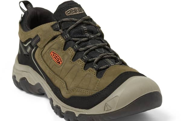
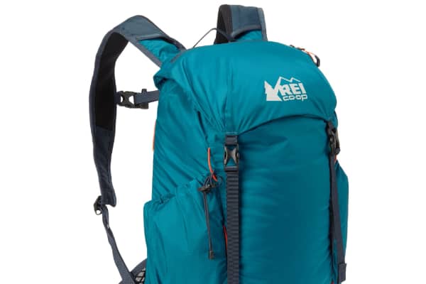
Hiking Gear
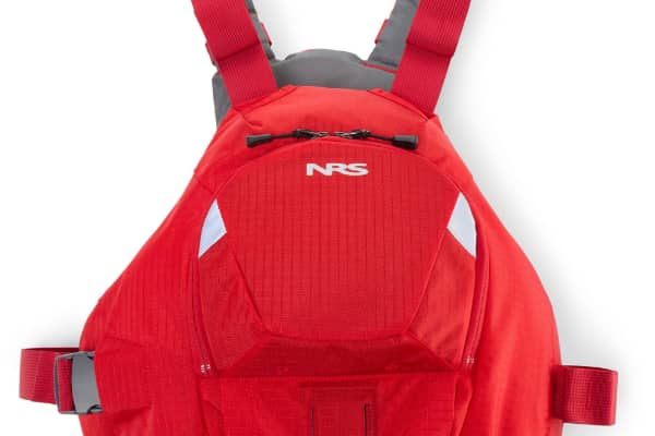
Kayak & Paddle Gear

Some links on this page are affiliate links. If you purchase through them, Explore Washington State may earn a small commission at no extra cost to you. We only recommend gear we believe in.
Washington State Parks Directory
The Washington State Parks Directory covers all 146 state parks across Washington — from saltwater shores and mountain meadows to ancient lava tubes and desert canyons. Find trails, camping, activities, and detailed visitor information for every park in the state.
Browse All Washington State Parks