
Larrabee State Park
Region
Northwest Washington
Washington’s first state park. Established July 20, 1915, which means every other state park in the system came after this one. The Larrabee family donated the original 20 acres in memory of Charles Xavier Larrabee, a Bellingham businessman who had wanted the land kept public. That story is in the History section below.
The park today is 2,748 acres straddling Chuckanut Mountain and the Samish Bay shoreline, about 7 miles south of Bellingham off Chuckanut Drive (Highway 11). Beach and tidepools at Wildcat Cove, sandstone formations shaped by wave and weather, a boat launch, a campground in second-growth forest, and a trail system that climbs into the Chuckanuts with connections to Fragrance Lake, Lost Lake, and the broader Chuckanut and Interurban Trail network. Views west across Samish Bay to Lummi, Orcas, and the San Juans.
Who this park is not for: The BNSF mainline runs along the shoreline through the park. Amtrak Cascades and freight trains pass through multiple times a day and night. If you are looking for a silent waterfront camping experience, this is not it. If you like train horns in the distance and do not mind one at 2 AM, you will be fine. The campsites are also on slopes. Bring leveling blocks.
At a Glance
| Detail | Info |
|---|---|
| Location | 245 Chuckanut Drive, Bellingham, WA 98229 |
| Phone | (360) 676-2093 |
| Size | 2,748 acres |
| Shoreline | Approximately 8,100 feet on Samish Bay |
| Season | Year-round |
| Hours | 8 AM to dusk (varies seasonally — check parks.wa.gov for current schedule) |
| Entry | Discover Pass required ($45/year or $10/day) |
| Reservations | Yes, Washington State Parks reservation system (peak season); first-come, first-served off-season |
| Pets | Dogs allowed on leash |
| Fires | Allowed in designated fire pits and grills; check current burn ban status |
Getting There
From I-5, two approaches work. The scenic one is exit 250 in Bellingham (Fairhaven district), then south on 12th Street which becomes Chuckanut Drive. About 7 miles, 15 minutes, and the drive itself is a designated Scenic Byway carved into the hillside above the bay. The other approach is exit 231 at Burlington, then north on Chuckanut Drive through the Skagit Flats and up the south end of the byway. About 20 miles, 30 minutes, and arguably the prettier half of the road.
From Seattle, about 90 miles north, 1 hour 45 minutes without traffic. From Bellingham, 15 minutes. From Anacortes, about 35 minutes north.
Chuckanut Drive is narrow, winding, and often slow behind someone taking in the view. Budget more time than the map suggests.
Camping
The campground sits in second-growth Douglas fir and cedar forest above the shoreline, on the inland side of Chuckanut Drive. You do not camp on the beach. You camp in the trees and walk down.
| Site Type | Count | Details |
|---|---|---|
| Standard (no hookups) | ~51 | Picnic table, fire ring, grill |
| Utility (water + electric) | ~26 | Picnic table, fire ring, grill |
| Primitive | 8 | Walk-in, no vehicle access |
| Group camp | 1 | Up to 40 people |
Restrooms and showers: Flush toilets and hot-water showers. Showers are free. Dump station on site.
Slopes: Most pads have a slope. This is a hillside park. Bring leveling blocks or expect to sleep with your head downhill.
Campsite Fees
Standard and utility sites are priced by tier and season through the Washington State Parks reservation system. Check parks.wa.gov for current rates.
Reservation Tips
Peak summer weekends book out months ahead. Reservations open nine months in advance through the state system. Midweek is realistic into July. After Labor Day, availability loosens considerably. Off-season camping is first-come, first-served with shorter max stays.
52 Things to Do at Washington State ParksA free printable checklist: one adventure per week for a full year.
Get the Free ChecklistTrails
The trail system is the reason a lot of people come here, and most of them come for one trail in particular.
Fragrance Lake Trail
5.5 miles round trip. 1,050 feet of elevation gain. Moderate. About 2.5 to 3 hours.
The iconic Larrabee hike. Starts across Chuckanut Drive from the main park entrance at the signed trailhead. The route climbs switchbacks through second-growth fir and cedar, passes a short spur to a viewpoint with a straight-west look over Samish Bay to the San Juans, then levels off through quieter forest before reaching Fragrance Lake. The lake is small, tree-ringed, and usually has a loop trail around the shore. Plan an hour at the top. The viewpoint spur is worth the 5-minute detour on the way up when you still have legs for it.
Lost Lake Trail
7 to 9 miles round trip depending on route. 1,800 feet of elevation gain. Strenuous. Half-day minimum.
The longer, quieter cousin of Fragrance Lake. Climbs higher into the Chuckanuts with access to Lost Lake and connections to the broader Chuckanut trail network including Raptor Ridge. Fewer people, longer day, better views. Bring a map. Junctions are signed but the network is complex and several trails branch off.
Interurban Trail
6.2 miles from Fairhaven to Larrabee. Flat to gently rolling. Hikeable and bikeable.
The old interurban rail grade from Bellingham to Mount Vernon, converted to trail. The Larrabee end connects to Fairhaven and makes a point-to-point car-free option if you can arrange a shuttle or bike back. Bikes are allowed on the Interurban portion but not on the steeper backcountry trails inside the park.
Clayton Beach Trail
0.7 miles one way. 200 feet of elevation loss. Easy down, moderate back up.
Separate trailhead about a mile south of the main park entrance on Chuckanut Drive, with its own small parking lot. The trail crosses the railroad tracks via a pedestrian underpass and drops to Clayton Beach, a sandy beach with large sandstone formations and tafoni weathering patterns. Quieter than Wildcat Cove on weekends. Check tides before you go. At extreme high tide the beach narrows considerably.
Activities
On the Water
- Beach and tidepools at Wildcat Cove. The main day-use beach. Rocky shoreline with tidepools at low tide. Expect barnacles, sea stars, anemones, and small crabs in the pools. The sandstone formations along this shore show honeycomb weathering called tafoni that is specific to Chuckanut sandstone. Low tide is the window. A minus tide in summer is the best of it.
- Boating. Concrete boat launch at Wildcat Cove with seasonal docks. Access to Samish Bay and the broader Puget Sound from here. Launch fee plus Discover Pass required.
- Kayaking and paddleboarding. Launch from the beach at Wildcat Cove. Samish Bay is protected on calm days. The crossing to Chuckanut Island or toward Governors Point is a popular short paddle. Afternoon winds are usually stronger than morning.
- Crabbing. Recreational crabbing in Samish Bay during open season. WDFW license required. Check season and catch limits before dropping pots.
- Fishing. Saltwater fishing from shore or boat. Washington State fishing license required. Check WDFW regulations.
- Scuba diving. Divers use the shoreline at Wildcat Cove for shore entry. Cold water, rocky bottom, moderate visibility.
On Land
- Hiking. See the Trails section above. Fragrance Lake is the signature hike. Lost Lake is the bigger day. Clayton Beach is the short version.
- Rock climbing. The Chuckanut sandstone outcrops above the park have established climbing routes, mostly bouldering and short trad lines. The sandstone is soft and climbs differently than granite. This is not a beginner destination. Climbers coming from elsewhere should connect with the local community at Western Washington University or Vertical World Bellingham for current route conditions.
- Bird watching. The park sits on the Pacific Flyway. Bald eagles year-round, often visible from the bluffs. Great blue herons at the tideline. Harlequin ducks in winter. Varied thrushes and pileated woodpeckers in the forest.
- Wildlife. Black-tailed deer, raccoons, and river otters at the shore. From the bluffs and beach, look for harbor seals, porpoises, and occasional orcas in Samish Bay. Gray whales pass through in spring, making the bluffs and beach a solid spot for whale watching from shore.
- Ranger programs. Seasonal interpretive programs when staffed. Check with the park for current schedules.
- Geocaching. Active caches in the park. Search Geocaching.com.
On-Site Services
No concession stand. No camp store. Bring your own food, firewood, and supplies. Firewood may be available for purchase at the contact station during peak season when staffed. Bring your own as backup.
Nearest full services are in Fairhaven (7 miles north) or Bow/Edison (10 miles south on Chuckanut Drive).
Good to Know
- Train noise is real. BNSF mainline runs along the shoreline through the park. Amtrak Cascades plus freight, day and night. Campers in the main loops hear trains. This is not a flaw to work around. It is the park. Know before you book.
- Leveling blocks. Most campsites are on a slope. Bring them.
- Tides matter at Wildcat Cove. The tidepools and sandstone formations only show at lower tides. Check the Samish Bay tide table the morning of. A minus tide in summer is the single best time to be here.
- Chuckanut Drive is slow. Narrow, winding, and often stuck behind someone sightseeing. Add 10 minutes to any trip along it. It is also one of the best scenic drives in the state, so factor that as a feature not a bug.
- Fragrance Lake parking. The trailhead lot across from the main entrance fills by 10 AM on summer weekends. Start early or park inside the day-use area and walk across.
- Cell service. Verizon and AT&T coverage is adequate at the campground and day-use areas. Spottier on the trails once you are a mile in.
- Two entrances, one park. The main entrance has the campground, day-use area, and Wildcat Cove. Clayton Beach has its own lot a mile south. They are not connected by park road. Pick which one you want before you turn off Chuckanut Drive.
A Bit of History
Charles Xavier Larrabee was a Bellingham businessman and one of the principal developers of Fairhaven, the neighborhood at the south end of Bellingham Bay. He and his brother-in-law Cyrus Gates bought the land that is now the park in the early 1900s with the intention of preserving it. Larrabee died in 1914.
In 1915, his widow Frances Payne Larrabee and Cyrus Gates donated 20 acres along Samish Bay to the State of Washington for use as a park. On July 20, 1915, the State Board of Park Commissioners accepted the donation and formally established the site as a state park. It was the first. Every state park in Washington that came after, including Deception Pass, Sol Duc, Mount Spokane, and the nearly 140 others in the system, followed from that 20-acre gift.
The park has grown through additional acquisitions over the last century to its current 2,748 acres. The Civilian Conservation Corps worked here in the 1930s and built several of the stone structures and trails that are still in use today.
The entrance sign still identifies the park as Washington’s first.
Fees
| Fee | Amount |
|---|---|
| Discover Pass (annual) | $45 |
| Discover Pass (one day) | $10 |
| Watercraft launch | $7/day |
| Trailer dump | $5/use |
| Overnight unattended vehicle | $10/night |
Campsite fees vary by site type and season. Check parks.wa.gov for current rates.
Nearby
- Fairhaven (Bellingham). 7 miles north. The south-of-Bellingham historic district with restaurants, bookstores, and the Alaska Ferry Terminal. Village Books and a solid Saturday farmers market in summer. This is your supply run and also your dinner if you do not want to cook at camp.
- Taylor Shellfish Samish Bay Farm. 10 miles south on Chuckanut Drive in Bow. Working oyster farm with a retail counter where you can buy oysters, clams, and mussels fresh off the boat and eat them on picnic tables overlooking the bay. The most on-brand meal for a Larrabee camping trip.
- Chuckanut Bay oyster and wine loop. The stretch of Chuckanut Drive between the park and Bow includes several destination restaurants (the Oyster Bar, Chuckanut Manor) and Samish Bay shellfish farms. Reserve dinner ahead for Saturday nights.
- Bow and Edison. 10 miles south. Two small artist towns. Bow has Breadfarm bakery and the Edison schoolhouse. Edison has Slough Food, the Old Edison (live music), and Tweets Cafe. Worth a morning if you are already camping here.
- Anacortes and the San Juan Islands ferry. 35 minutes south. If you want to add a San Juan day trip to your camping weekend, Anacortes is the terminal. Book the ferry in advance in summer.
- Galbraith Mountain. 20 minutes north in Bellingham. One of the better mountain biking trail systems in the state. Worth a day if you have bikes.
Official Source
What to Do
Activities
Common Questions
Frequently Asked Questions
Do you need a Discover Pass to visit Larrabee State Park?
Yes. Washington State Parks requires a Discover Pass for all vehicles parking at state recreation lands. A daily pass costs $10 and an annual pass costs $45. You can purchase one online at discoverpass.wa.gov, at a sporting goods retailer, or at the park entrance. Camping fees are charged separately and do not include a Discover Pass.
Are dogs allowed at Larrabee State Park?
Yes, leashed dogs are welcome at Larrabee State Park. Dogs must be kept on a leash no longer than 8 feet at all times and must have proof of a current rabies vaccination. Dogs are not permitted in designated swimming areas or inside park buildings. Please clean up after your pet to keep the park enjoyable for everyone.
Can you camp at Larrabee State Park, and how do you make a reservation?
Yes, Larrabee State Park offers tent sites and utility hookup sites across two campground areas. Reservations can be made through the Washington State Parks reservation system at reservations.washington.gov. The park is extremely popular in summer so booking well in advance is strongly recommended. Walk-in sites may be available on a first come, first served basis when space allows.
Is Larrabee State Park open year round?
Larrabee State Park is open year round, though some facilities and services are seasonal. Day use areas and trails are generally accessible throughout the year. Campgrounds typically operate from spring through fall. Winter weather can affect road conditions and access, particularly at higher elevation parks. Check the Washington State Parks website for current conditions and seasonal closures before your visit.
What are the best things to do at Larrabee State Park?
Larrabee State Park offers hiking through old growth forests, rocky saltwater beaches perfect for tidepooling, stunning views of the San Juan Islands, and some of the best mountain biking trails in Whatcom County. The hike to Oyster Dome rewards visitors with panoramic views stretching from the islands to the Cascades. Whether you are swimming, paddling, picnicking, or exploring tide pools at low tide, Larrabee delivers a complete Pacific Northwest outdoor experience.
Who is Larrabee State Park named after?
Larrabee State Park is named after Charles Xavier Larrabee, a prominent Bellingham businessman and civic leader. In 1915 his family donated the original land that became the park, making it Washington's first state park. The Larrabee family's gift established what is now one of the most beloved parks in the Puget Sound region, offering saltwater beaches, forested trails, and sweeping views of the San Juan Islands.
Trip Planning
What to Pack
Required Pass
Required for parking at all Washington State Parks. One pass covers your vehicle for a full year.
$46.99
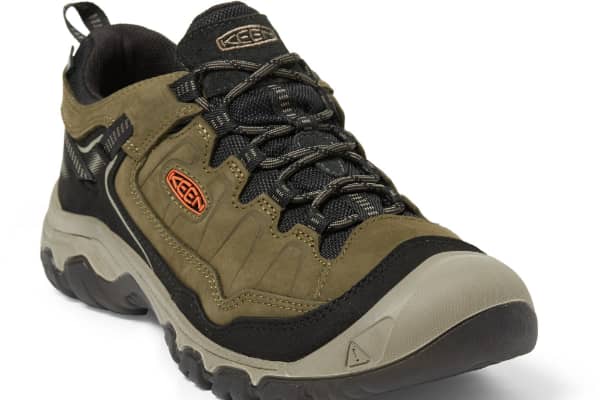
Hiking Gear
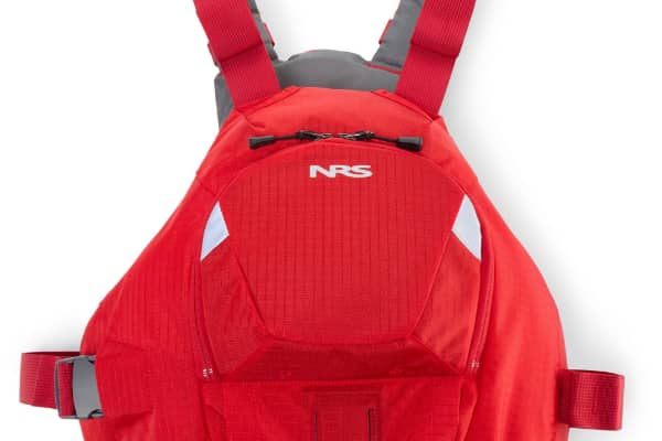
Kayak & Paddle Gear

Some links on this page are affiliate links. If you purchase through them, Explore Washington State may earn a small commission at no extra cost to you. We only recommend gear we believe in.
Washington State Parks Directory
The Washington State Parks Directory covers all 146 state parks across Washington — from saltwater shores and mountain meadows to ancient lava tubes and desert canyons. Find trails, camping, activities, and detailed visitor information for every park in the state.
Browse All Washington State Parks