
Pierce County, Washington · Seattle & Puget Sound
Orting
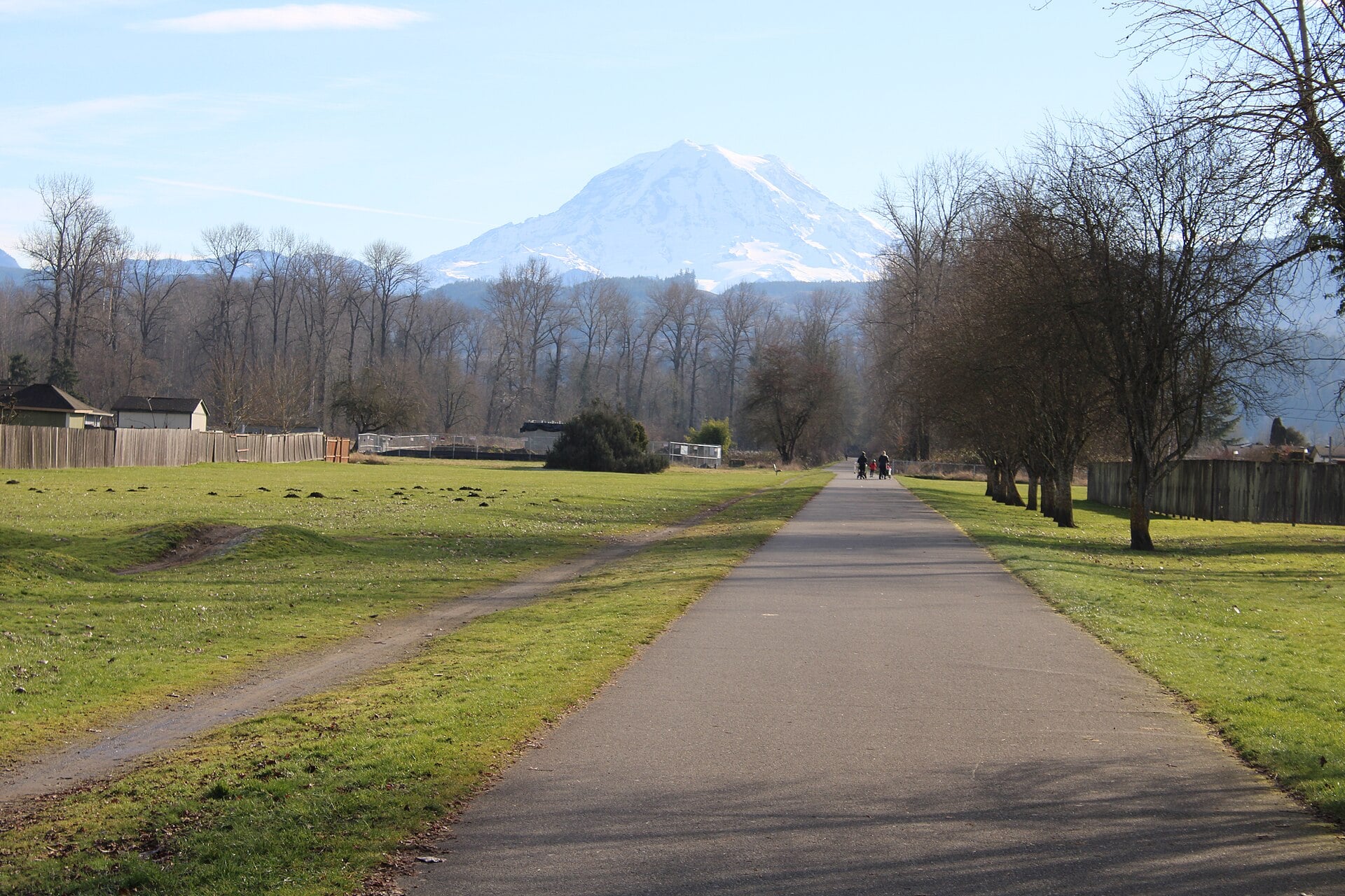
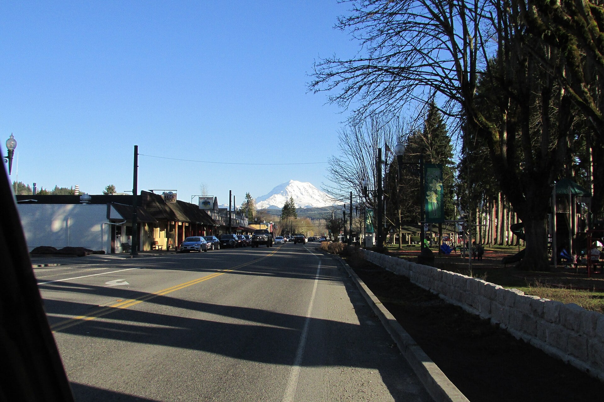
Mount Rainier fills the sky at the end of every street in Orting, a valley town where daffodil farms gave way to one of the best rail trails in Washington.
POPULATION
8,900
INCORPORATED
1889
FROM SEATTLE
About 1 hour
COUNTY
Pierce
KNOWN FOR
Mount Rainier views
RAIL TRAIL
22 miles
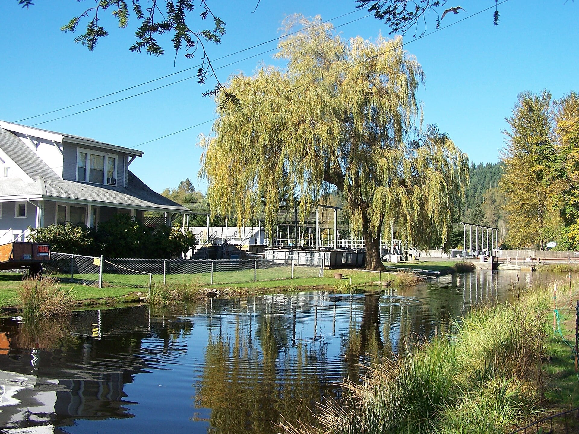
Orting, Washington sits on the floor of the Puyallup River valley between two rivers fed by Mount Rainier glaciers, and the mountain dominates the view from nearly every corner of town. The townsite took its name from a Northern Pacific Railway superintendent in 1877 and incorporated in April 1889, making it one of the oldest cities in Pierce County. Hops came first, then daffodil and berry farms that once shipped bulbs around the world, a legacy the town still celebrates every April when the Daffodil Festival parade makes its final stop on Washington Avenue.
Today the draw is simpler: Orting is the best place in the South Sound to put yourself in front of Mount Rainier without driving into the park. The Foothills Trail runs straight through the center of town, and the stretch heading toward South Prairie is widely considered the most scenic section of the entire 22 mile route. Orting is also famous for something it would rather not be: the town sits in the path of a potential lahar from Mount Rainier, and its warning sirens and regularly practiced evacuation drills have made it one of the most volcano prepared communities in America. For visitors, that fact adds a layer of respect to the view. The mountain here is not scenery. It is a neighbor.
Getting Here
Orting sits on SR 162, the two lane highway that loops through the Puyallup River valley. From Seattle, take SR 167 south to SR 410 east at Sumner, then follow SR 162 south into town, about an hour of driving depending on traffic. From Tacoma, SR 512 to Pioneer Way East connects to SR 162 at McMillin, about 30 minutes total. The valley road is flat and scenic but busy on weekday afternoons, so build in a cushion around commute hours. Parking is straightforward: the Foothills Trail trailhead at the city park has a dedicated lot, and downtown street parking along Washington Avenue is free.
Things to Do
Outdoors
Ride the Foothills Trail to South Prairie
The 7.5 mile paved stretch from Orting to South Prairie follows the Carbon River through farmland with Mount Rainier dead ahead, and many riders call it the best section of the whole 22 mile trail. Start at the trailhead in the center of town and watch for horses; the trail is shared.
Recreation
Golf High Cedars with the Mountain Watching
High Cedars Golf Club plays 27 holes on the valley floor, a Championship 18 and an Executive 9, with Mount Rainier looming over the fairways. Public tee times run daily and the course stays open year round, weather permitting.
History
Washington Soldiers Home and Cemetery
Veterans have lived at the Soldiers Home southwest of town since the 1890s, and its hillside cemetery holds more than 2,200 graves including four Civil War Medal of Honor recipients. Visit respectfully; the grounds offer some of the quietest Rainier views in the valley.
Culture
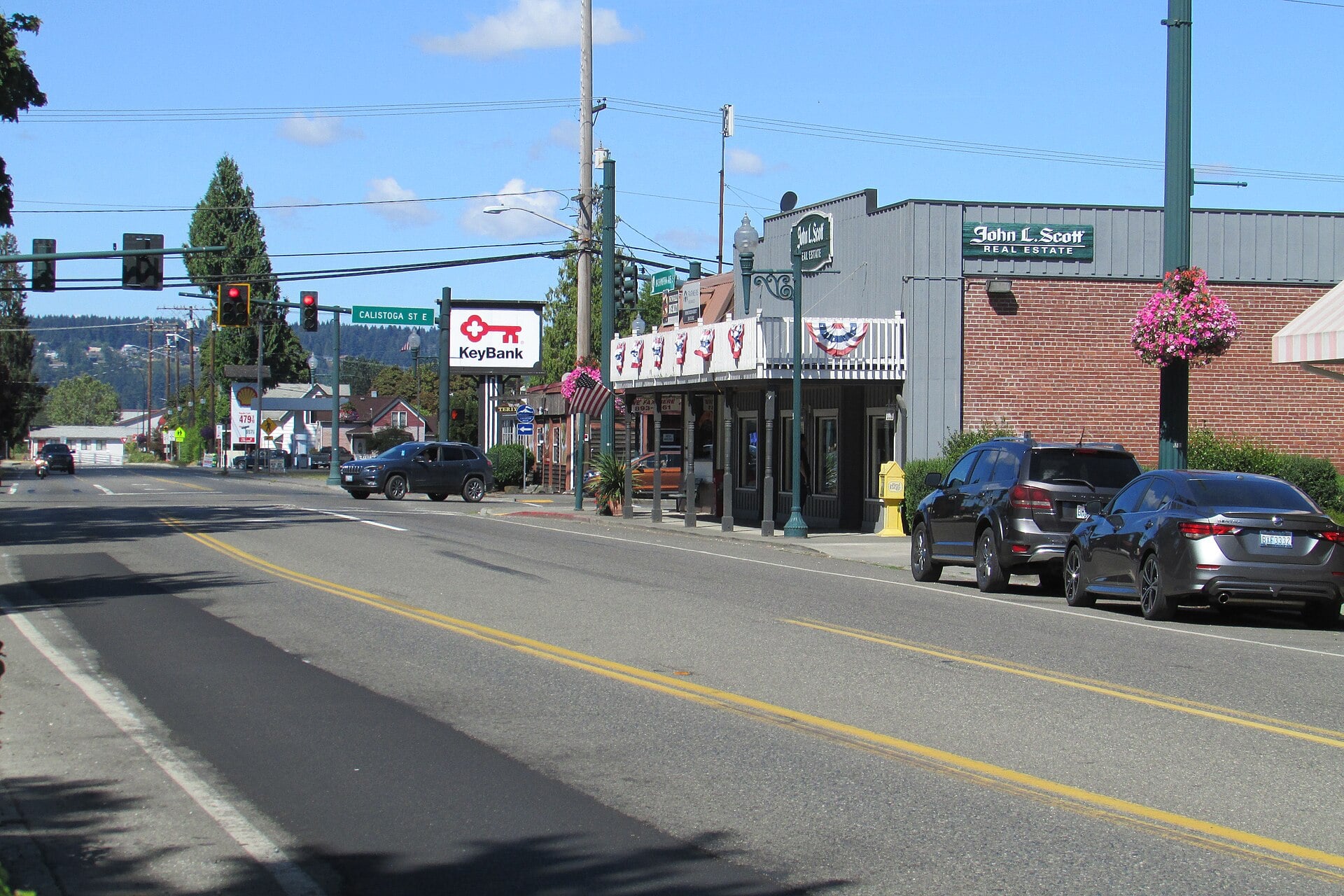
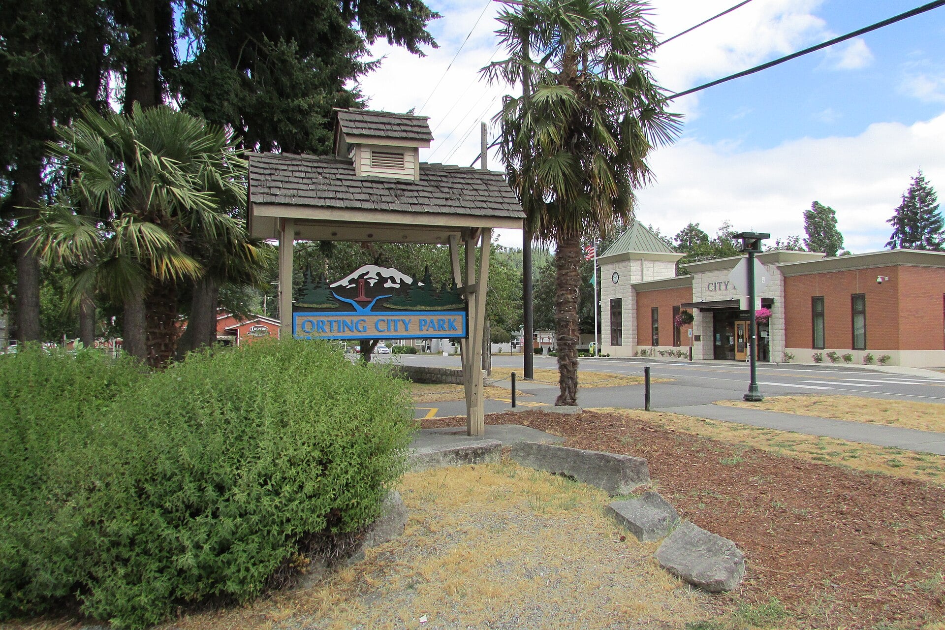
Walk Downtown Past the Bell Tower
Washington Avenue keeps its turn of the century bones: the Orting Bell Tower, the street clock, and brick storefronts from the railroad era. The whole walk takes twenty minutes and ends at the city park.
Nature
Voight Creek Fish Hatchery
This working hatchery on the Puyallup River system raises coho and chinook, and coho return to the creek each fall. The grounds sit just south of town; check WDFW for current visitor access before you go.
Family
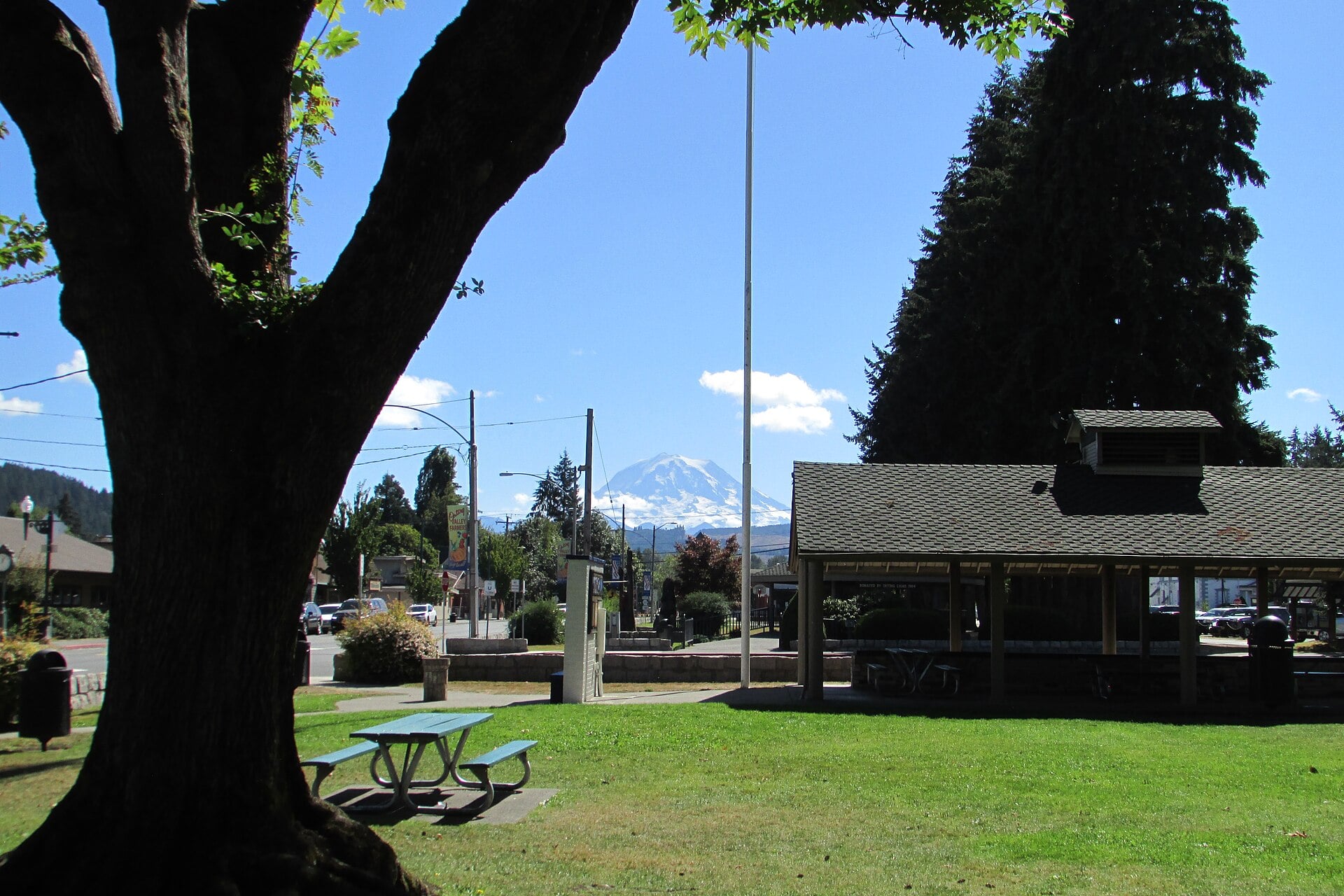
Picnic at the City Park Trailhead
Orting’s central park anchors the Foothills Trail with playgrounds, picnic shelters, and summer community events. It is the natural base camp for a trail day with kids.
“Stand on Washington Avenue on a clear morning and Mount Rainier looks close enough to touch, fourteen thousand feet of volcano filling the southeastern sky.”
Explore Washington State
Where to Stay
Holiday Inn Express & Suites Sumner Puyallup Area
Fifteen minutes north of Orting, the closest reliable hotel beds to the trail, with breakfast included and easy SR 410 access.
Check ratesFairfield Inn & Suites Tacoma Puyallup
Modern rooms near the fairgrounds, about 20 minutes from Orting, well positioned for combining the valley with Tacoma.
Check ratesValley and foothill vacation rentals
Orting proper has no hotels, but rental homes and cabins in the surrounding valley put Mount Rainier outside the window.
Browse rentalsFind a Cabin Near Orting
Find a Cabin Near Orting
Food & Drink
Tim’s Kitchen on Washington Avenue is the town diner, known for chicken and waffles and a properly built Reuben; expect a wait on weekend mornings. Route 66 Pizza covers the other end of the comfort food spectrum with generously portioned pizzas and calzones that easily feed two. L&M Firehouse has reopened after its remodel and is back to serving bar and grill fare and cold drinks in a relaxed downtown setting. Cyclists on the Foothills Trail treat Orting as the refuel stop, and on summer weekends the espresso stands along SR 162 do a steady business in cold drinks.
Festivals & Events
April
Daffodil Festival Grand Floral Parade
Orting hosts the final leg of the four city parade that has rolled through Pierce County since 1934; the 2026 edition was the 93rd. Floats finish their day on Washington Avenue in front of a hometown crowd.
July
Fourth of July Festival in the Park
An afternoon of food, music, and family games in the city park to celebrate the holiday.
August
Orting Summerfest
End of summer community festival with vendors and live music, typically held in late August.
September
Orting Harvest Festival
A fall market day celebrating the valley’s farm roots, typically held in late September.
October
Red Hat Days
Orting’s longest running quirky tradition, a fall festival of markets and community events, typically held in early October.
December
Home for the Holidays
Tree lighting and an evening festival that closes the year downtown.
Day Trips
Sumner is 10 minutes north on SR 162, where the Old Cannery Furniture Warehouse and a walkable antique district anchor a classic small downtown. Puyallup and the Washington State Fairgrounds are about 20 minutes northwest. For the mountain itself, drive SR 162 to SR 165 through the old coal towns of Wilkeson and Carbonado to reach the Carbon River entrance of Mount Rainier National Park, about 45 minutes from town; Wilkeson’s sandstone school and beehive coke ovens are worth the stop on their own. Lake Kapowsin, 15 minutes south, offers quiet bass fishing under the mountain.
Planning Your Visit
April through October is prime time. April brings daffodil bloom and the parade, summer delivers the clearest mountain views for the trail, and September and October trade crowds for crisp air and salmon moving up Voight Creek. Orting itself is a half day: ride or walk the trail, eat downtown, and photograph the mountain. Pair it with Sumner or the Carbon River corridor for a full day. The town has no hotels, so plan to stay in Puyallup or Sumner, or book a cabin in the surrounding foothills. One practical note: if you hear a siren on a scheduled test day, that is the lahar warning system checking itself, not a reason to leave.
More Orting on EWS


Frequently Asked Questions
What is Orting, Washington known for?
Orting is known for its head on views of Mount Rainier, its daffodil farming heritage celebrated in the annual Daffodil Festival parade, and the Foothills Trail, whose most scenic miles run right through town. It is also recognized as one of the most lahar prepared communities in the country, with a warning siren system and regular evacuation drills.
Is Orting worth visiting?
How do you get to Orting, Washington?
Orting sits on SR 162 in the Puyallup River valley. From Seattle, take SR 167 to SR 410 at Sumner, then SR 162 south, about an hour total. From Tacoma it is roughly 30 minutes via SR 512 and Pioneer Way East.
Is Orting safe to visit given the lahar risk from Mount Rainier?
Day to day risk for visitors is minimal. Orting sits in a mapped lahar zone, which is why it operates warning sirens and signed evacuation routes, and the USGS monitors Mount Rainier around the clock. Geologic events on that scale are rare; the preparation is what makes the town notable.
How many people live in Orting?
About 8,900 people as of recent estimates, and the town has been one of Pierce County’s faster growing small cities over the past two decades.
When is the best time to visit Orting?
April for daffodil bloom and the parade, or July through September for the clearest mountain views on the Foothills Trail. Fall brings salmon runs and quieter trail miles.