Hiking Washington’s Southern Coastal Route
A good hike for the colder months ahead: that became my mission the last few weeks as I contemplated my upcoming article on hiking. I had recently gotten back from a trip up Sol Duc to Appleton Pass and The High Divide, and although wonderful in so many ways, I had also encountered the first snow of the season and some pretty chilly conditions.
After this experience, my thoughts were pointed toward a lower elevation for this hiking feature if only just to keep the temperature at a more moderate level. Here on the Olympic Peninsula the choices seem to be either mountains or coast. I had already hiked to the Shi Shi Beachhead and Cape Flattery earlier this year on a west-end excursion and re-sampled the beauty of Pacific Northwest Coastal Beaches. It wasn’t until talking with a mentor of mine though that I came up with the plan for my cold-weather hiking backpack trip along the Southern Coastal Route.
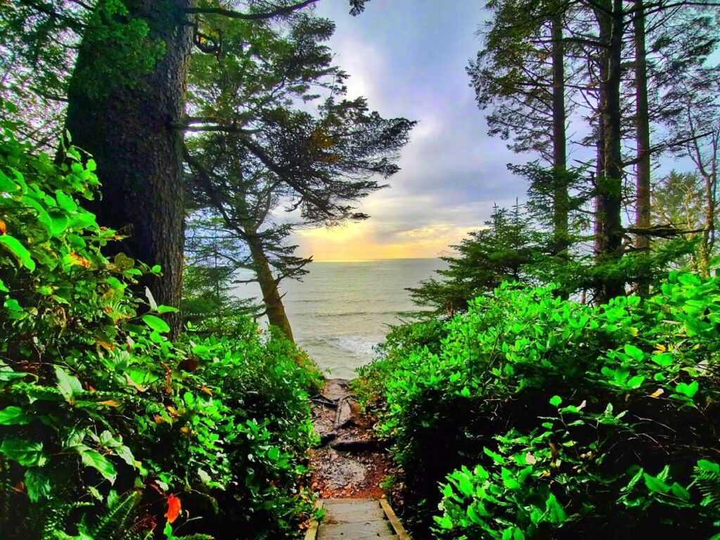
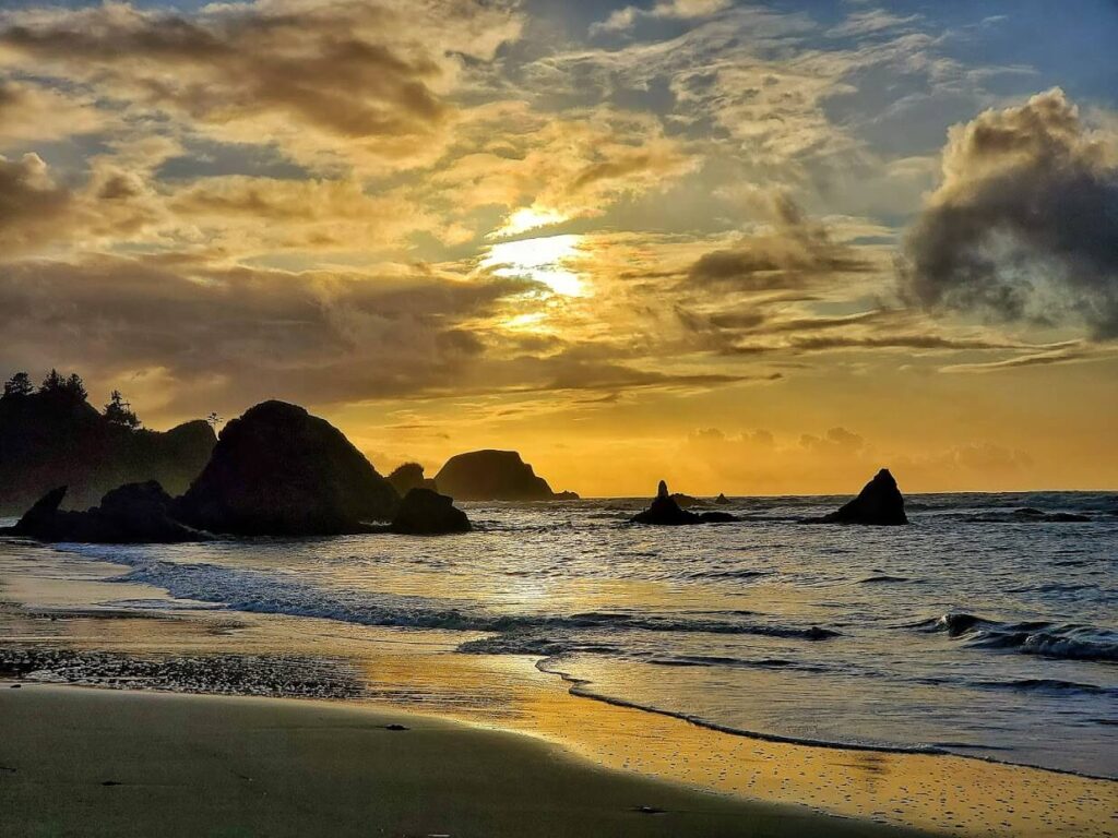
La Push-Third Beach Trailhead
Initially I had planned on starting at what is known as the Oil City Trailhead, on the northern side of the Hoh River mouth. After weeks of planning for the specific weekend of the 18th of October however, I was advised by park officials to reverse my route and start in from the La Push-Third Beach Trailhead. The new itinerary was to avoid impassable tides from the current storm surge and still be able to complete the majority of the route.
I had my dry bags packed and headed west on Highway 101 Friday morning after my pre-hike massage and chiropractic adjustment at Boulevard Wellness Center. I stopped in at a new favorite – Granny’s Café – for a huge breakfast on the way out, as I knew my diet over the next few days would consist mainly of granola and pepperoni sticks.
I got out to the Third Beach Trailhead parking area after noon. I had consulted the tide charts prior to my trip to see that the high tide was at approximately 3:30 p.m. The topographical area map I had gotten for the trip didn’t show any specific high tide areas along the beachfront to the first headlands so I assumed I would be in the clear; when I came out on the other side, I would be following the tide out along the trail (obviously my preference). This did not turn out to be the case.

I don’t have much experience with this area, so I can’t say if it was particularly caused by the heightened tide levels of the storm surge, but even this first beachfront was impenetrable upon arrival.
With waves pounding up against a rock and driftwood outcrop along my path, I scrambled up a mushy clay embankment with my close to 60-pound pack to wade through thigh-deep slop that suctioned my boots and rain gear with a staggering grip.
Farther on I saw that logs stuck out in a perpendicular array even farther than my current lookout crest, and I hunkered down in a spring bed atop a boulder for the tide to recede enough to pass.
The lone day hiker who was able to attempt a higher route than me with his micro-pack apparently abandoned his pursuit after seeing this impenetrable barrier, and so I weathered the sea spray and drizzle unaccompanied until the waves backed off enough to attempt a semi-risky log-skirt approach through the breaking waves a bit after 4 p.m.
This was exactly the challenge of uncertainty and raw elemental wrath my heart had been longing for, and it was just the beginning of my journey.
I waded around a jutting log through waist-deep surf as the tide receded to lead me into the first headland trail section. This trail started with a roped climb along a muddy incline up the bluff and spun in to the first campsite along the trail. I had filled my backpack permit out to stay at this site but decided to press on farther and see if I could possibly get to the farthest campsite along the route tonight while the tide was going out: Mosquito Creek.
I trudged through the murky light and drizzle along coastal rocky outcrops and drift logs and up into headland trails marked by round white and red checkered signs. The light dimmed as I progressed at a much slower pace than anticipated, and I was soon donning my headlamp to view my surroundings.
Even this light was hampered by a particulate haze of water droplets condensing in the darkness. I was keeping a sharp eye to the tree line as not miss the next headland trail sign. The beach in this shuttered visibility had a gloomy ethereal quality that was a thrill all unto itself.
After walking along a stretch of beach past a curved point that surprisingly hadn’t diverted into a headland trail, I picked up various glimmers in the trees to my right that held the artificial reflector quality that discerned them from the various creature eyes I had caught in my lamp at earlier points that evening. After closer inspection, the reflections were coming from buoys strung up in the trees, a marker which I became familiar with along this journey as indicating either trail or campsite.
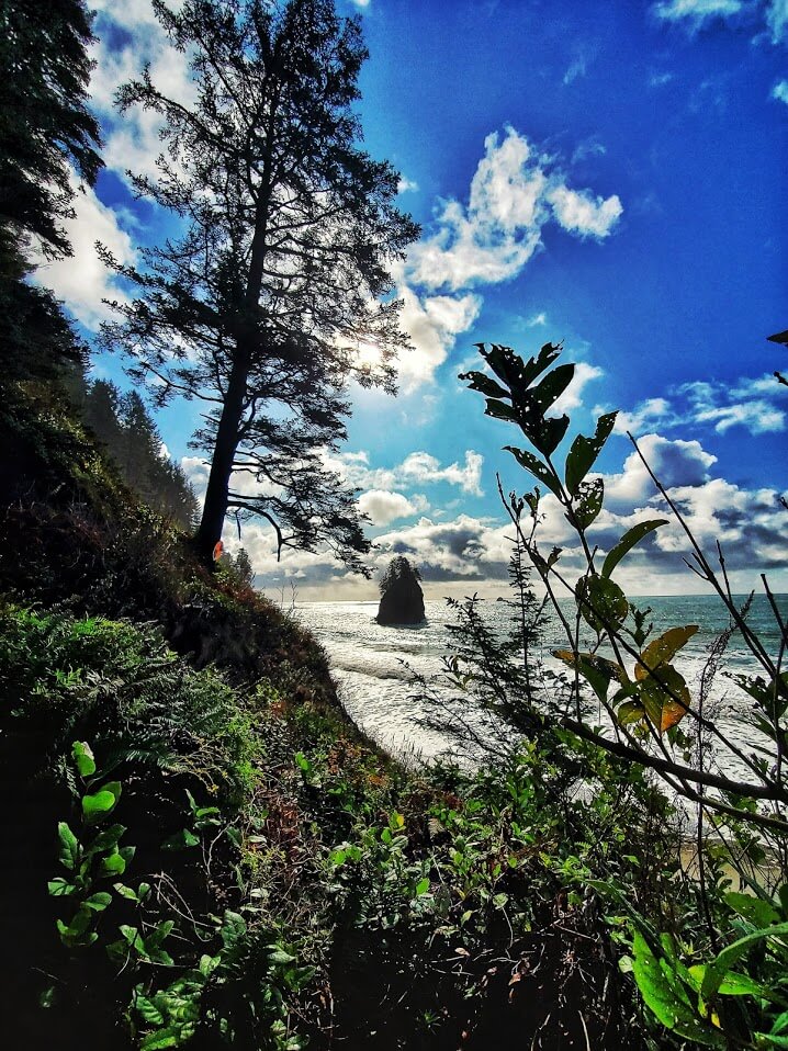
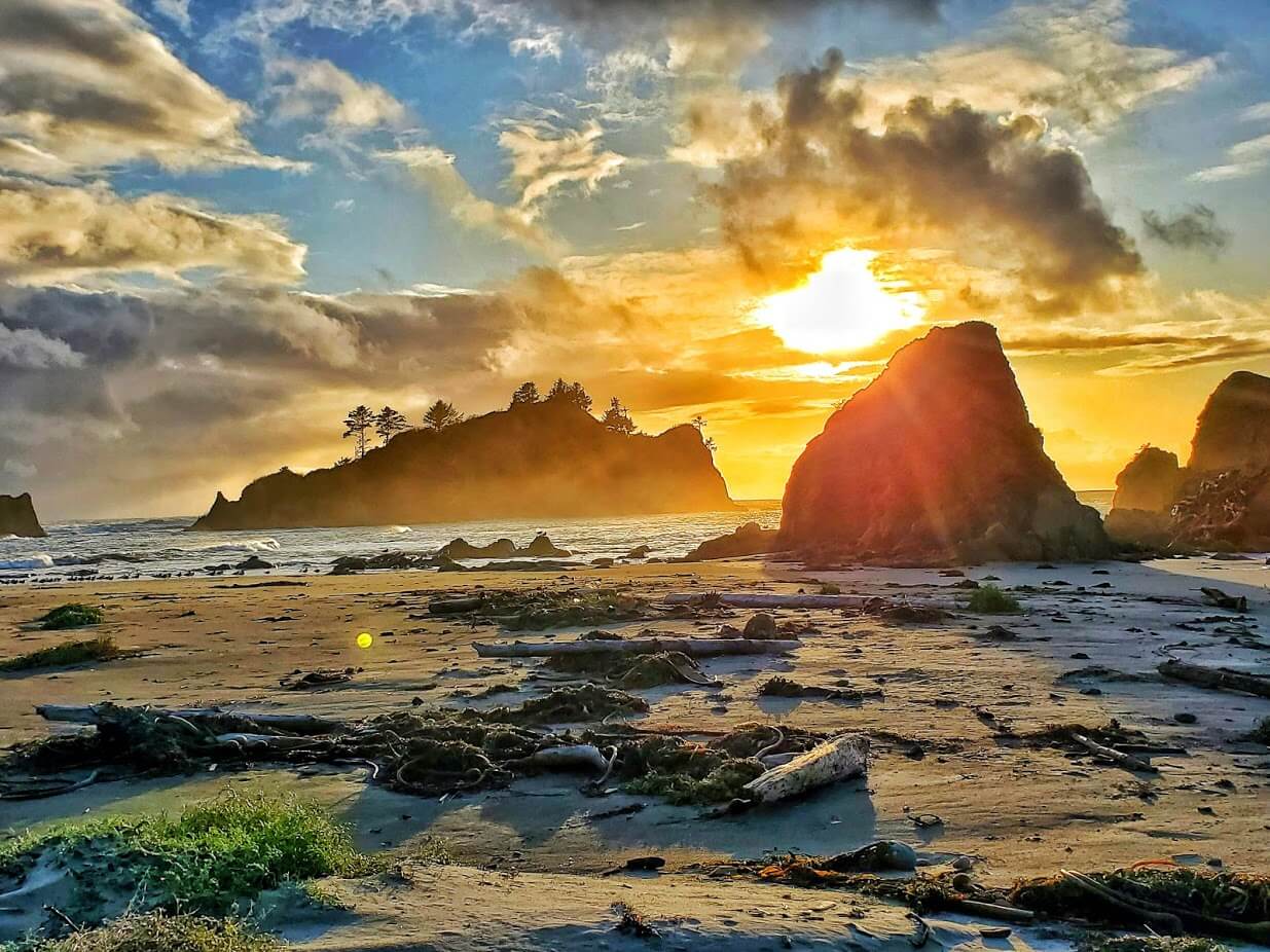
Toleak Camp
I woke up to the dimpled light of sun through trees and opened my tent to a view that was something between a scene from Robinson Crusoe and a Corona Commercial: the camp opened out onto the beach with a frame of needled branches, accentuated by the shipwreck-style hammock and rocky pillars protruding through the wave break offshore to the north.
I took advantage of the warm sun and coastal wind and lined the buoy ropes of the camp with my damp gear to dry. Consulting my moisture ragged maps, I was able to place myself at the Toleak Camp just north of Toleak Point referencing adjacent landmarks.
I went through my morning “festivities” and trudged down the beach a slog to replenish my water supply on the way to finishing out my route at least to the Mosquito Creek Camp with my day pack. This trail offers plenty of creeks and springs to keep your water supply topped off.
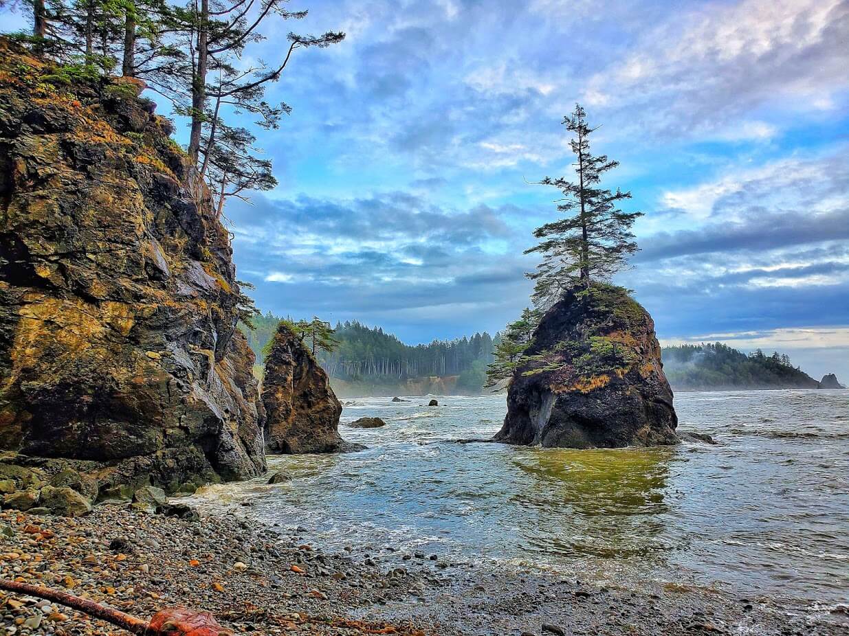
There wasn’t a single mile along this route I encountered that was devoid of a harvestable freshwater source (with proper filtration of course). There were several majestic rocky constructs between this camp and the next creek that created a stunning visual setting for this camp that was the focal highlight of my trip.
I proceeded past the next large creek mouth from Toleak Point into the next and longest section of headland trail along this route to Oil City. The rope climbs up to elevation here were especially rugged and shortly after a mile I encountered my first interior creek-crossing just after a stunning waterfall view across a broken-rock face.
There were several trails along this edge of Falls Creek, and the main path seemed to decompose into nowhere. After a closer investigation, the second of the three trails to the creek bank offered a natural bridge across a downed tree to the trail on the other side.
A short while after this, the larger of the two waters Goodman Creek, crosses the path. Although I had expected the creek to be lower this time of year, it was unfordable due to depth and current, and I was forced to turn back.
I consulted the rangers about this afterward and was informed that the creek is more likely to be passable during prime summer months (June to September).
Gear Up for Washington Weather
Washington trails are wet more often than not. Here is what we recommend for any day out on the trail. All three are available in men’s and women’s versions. (affiliate links)
Hiking Boots
KEEN Targhee IV Mid Waterproof
$180 | 4.3 stars (755 reviews)
Solid traction on muddy and rocky Washington terrain. The go to boot for trails in the Pacific Northwest.
Rain Jacket
The North Face Alta Vista
$160 | 4.5 stars (401 reviews)
You will need this even on days that start sunny. Washington weather changes fast, and a waterproof layer is non negotiable.
Day Pack
REI Co-op Flash 22
$59.95 | 4.3 stars (539 reviews)
Light, packable, and just the right size for a day hike. Carries your layers, water, snacks, and a rain jacket you will definitely need.
Heading Home
After topping off my water supply and visual fill of my journey’s endpoint, I traipsed back along the trail to the log-crossing of Falls Creek and started my search for my lost sunglasses back to Toleak Camp.
I had discovered they were missing upon crossing the log bridge and was unsuccessful in locating them after. If you find a tortoise shell pair of Costa Slack Tides along this route by chance, I would appreciate a DM!
The sun was beginning its decline and was offering up an ambient perspective of the coastal features for my return to camp. I decided to take in one last perfect evening and night at this paradise camp and woke up early to pack out the next morning.
The impassible Goodman Creek halted my journey at the halfway mark of 9 miles, putting my round trip at just over 18. This seems short compared to my previous mileage on even day trips, but my heavy pack and rugged trails and beachheads offered much more resistance than I have encountered along any trail previous.
I made an ultra-early start with the drizzle of the next day, breaking camp a bit after 3 a.m. and toiling back to the Third Beach parking area with fingers crossed that the thieves featured in posted warnings there had overlooked my tool-laden SUV.
This timing happened to be fortunate because a new weather front (or remnants of the previous) was already moving into the area and putting down some moderate precipitation by the time I broke out of the trail-end to my vehicle. Thankfully my automobile was still fully intact with all its innards unmolested. I will be taking on the second half of this route from Oil City in the future: stay tuned!
- About the Author
- Latest Posts
Zac was born and raised on the Olympic Peninsula. He enjoys nature and hiking and explores as often as he can. He also recently started dabbling in photography. Check out his Instagram feed.